Hazards and Population Mapper
Expert-developed at a federal agency
App Summary
App Screenshots
Detailed Description
Functionality & Mechanism
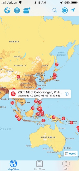
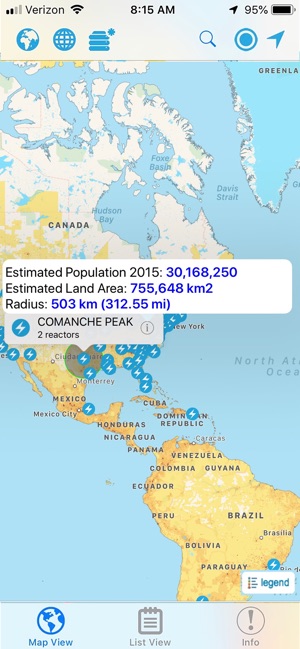
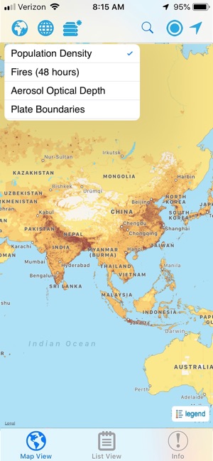
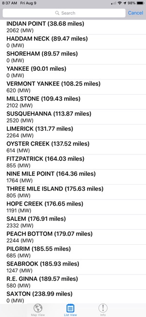
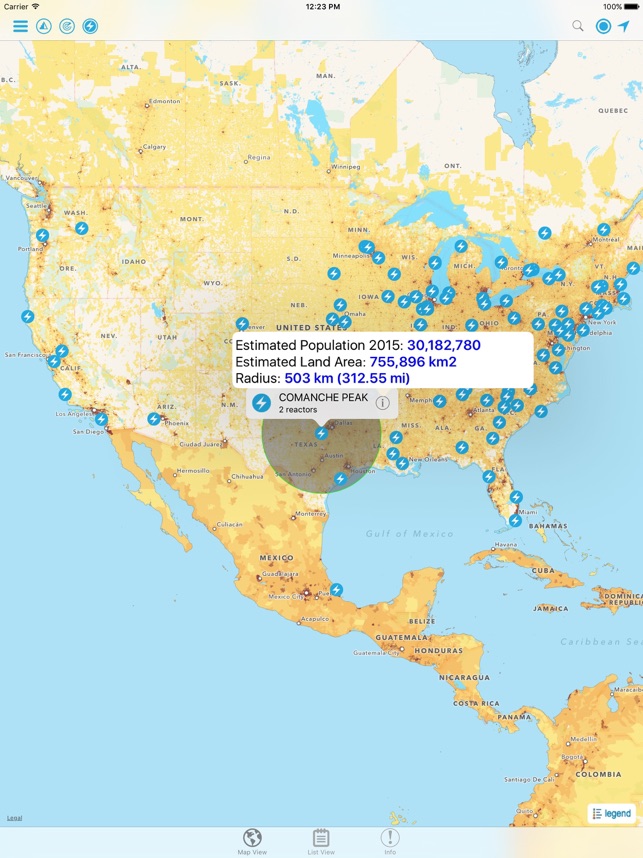
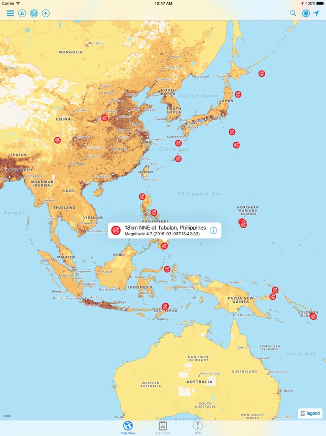
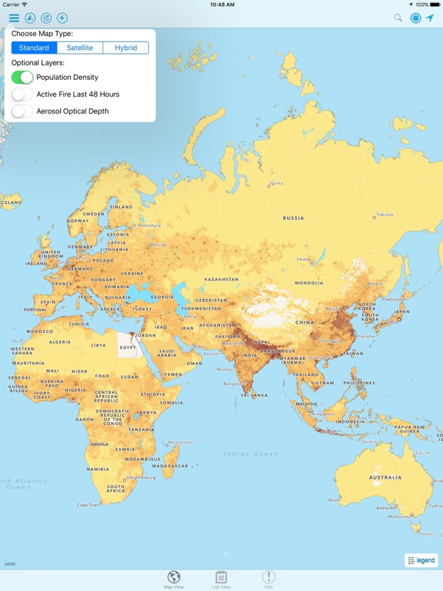
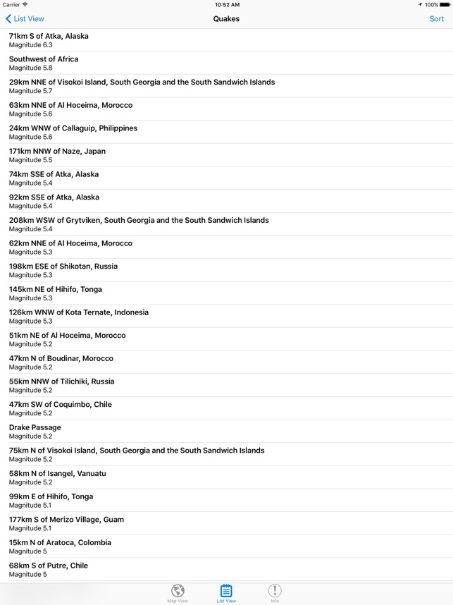
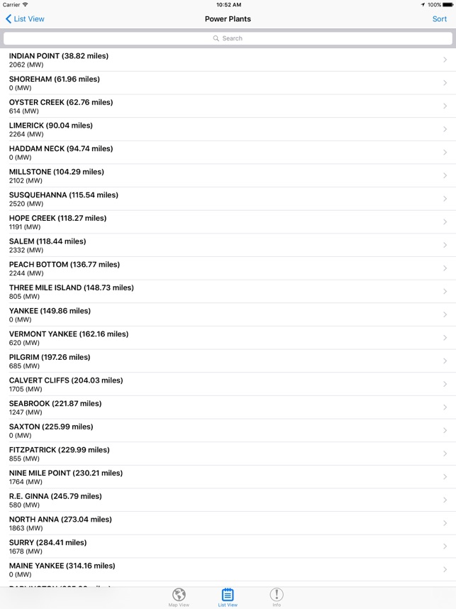
This interactive mapping platform, developed by the NASA Socioeconomic Data and Applications Center (SEDAC), integrates near real-time natural hazard data with global population information. The tool overlays data layers for active fires, earthquakes, and air pollution onto satellite imagery and infrastructure maps. Its primary mechanism allows users to delineate a specific area on the map to generate on-demand estimates of the enclosed population and land area, streamlining initial assessments of potential exposure during hazardous events.
Development & Context
- The tool was created to integrate population, infrastructure, and natural hazard data into a single, user-friendly application for rapid risk assessment.
- It leverages data from multiple U.S. agencies, including near real-time fire and aerosol data from NASA, earthquake alerts from USGS, and weather warnings from NOAA.
- The news coverage highlights its release as a mobile app for Apple devices, designed to broaden access for users in the field.
Intended Use & Scope
This tool is intended for disaster managers, humanitarian organizations, public health professionals, and journalists requiring a rapid, first-order assessment of populations potentially affected by a hazardous event. It is designed for preliminary planning and informational purposes and is not suitable for in-depth, location-specific risk analysis due to the coarse resolution of some datasets.
In the Media
SEDAC Hazards Mapper Provides a Rapid Assessment of Risk
NASA's Socioeconomic and Data Applications Center (SEDAC) developed the Hazards and Population Mapper to provide rapid assessment of populations and infrastructure impacted by natural disasters, using integrated datasets and real-time alerts. "The population layers we produce have always been a critical component in understanding degrees of exposure to different natural hazards," says SEDAC deputy manager Alex de Sherbinin. The app was released through the Apple iTunes Store and features three SEDAC datasets along with NASA near real-time active fire data, USGS earthquake alerts, and NOAA flood alerts.
Mapping Tool Lets Users Pinpoint Hazards Data
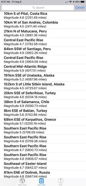
The NASA Socioeconomic Data and Applications Center developed the SEDAC Hazards Mapper to enable users to easily display natural hazards data in relationship to population and infrastructure, combining layers from various sources including NASA, USGS, and NOAA using open Web mapping services. The mapper shows active fires over the past 48 hours, earthquake alerts over the past seven days, and real-time U.S. flood and tornado warnings, while allowing users to estimate population within drawn areas of interest. SEDAC plans to add more hazard and infrastructure layers and update population data in early 2016.
App Information
Developer
NASACategory
Evidence Profile
Expert-developed at a federal agency
Platforms
Updated
Aug 2019
© 2025 NASA
Tags
Developer Links
Privacy PolicySimilar Apps
Hazards and Population Mapper
Free