TwoTrails
Expert-developed at a federal agency
App Summary
App Screenshots
Detailed Description
Functionality & Mechanism
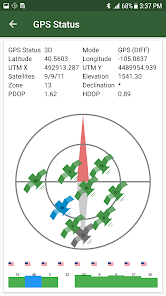
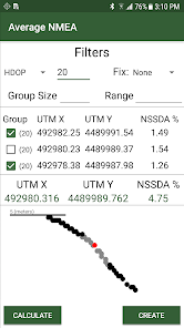
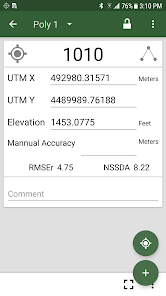
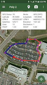
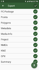
Developed by the Forest Management Service Center, TwoTrails is a data collection and management tool for forestry surveying and timber administration. The system accommodates surveying methods specified by the USDA Forest Service Handbook, enabling real-time data acquisition through GPS-based and conventional traversing techniques. The platform integrates field-collected data with pre-existing digitized information, including shapefiles and remote sensing data. Core functionalities include the generation of navigable grid sample points for field-based location and the automatic calculation of area-error for comparison with handbook standards. Outputs are exportable in multiple formats, including KMZ, GPX, and CSV.
Intended Use & Scope
This tool is intended for forestry professionals, particularly those conducting surveys for timber administration under USDA guidelines. It serves as a field instrument for capturing geospatial data and performing area calculations consistent with established protocols. This tool is intended to support, not replace, professional surveying judgment. Users should verify outputs against primary data sources. Data quality depends on user input and equipment capabilities.
App Information
Category
Evidence Profile
Expert-developed at a federal agency
Platforms
Updated
Jan 2026
© 2025 United States Department of Agriculture
Tags
Developer Links
Privacy PolicyTwoTrails
Free