AppsFromResearch
BayCurrents icon

BayCurrents

Published in academic literature

For:Researchers & AcademicsGeneral Public & Enthusiasts

App Summary

BayCurrents is a mobile reference tool providing high-resolution maps of surface water currents in the San Francisco Bay for recreational and professional maritime operators. The associated research explains that the app visualizes data from a high-resolution NOAA numerical model, which was developed to provide detailed spatial information on the bay's complex currents where direct observations are limited. While this data is intended to help optimize vessel operations and increase safety, the app provides experimental data for reference only and should not be used for primary navigation.

App Screenshots

BayCurrents screenshot 1 of 25BayCurrents screenshot 2 of 25BayCurrents screenshot 3 of 25BayCurrents screenshot 4 of 25BayCurrents screenshot 5 of 25BayCurrents screenshot 6 of 25BayCurrents screenshot 7 of 25BayCurrents screenshot 8 of 25BayCurrents screenshot 9 of 25BayCurrents screenshot 10 of 25BayCurrents screenshot 11 of 25BayCurrents screenshot 12 of 25BayCurrents screenshot 13 of 25BayCurrents screenshot 14 of 25BayCurrents screenshot 15 of 25BayCurrents screenshot 16 of 25BayCurrents screenshot 17 of 25BayCurrents screenshot 18 of 25BayCurrents screenshot 19 of 25BayCurrents screenshot 20 of 25BayCurrents screenshot 21 of 25BayCurrents screenshot 22 of 25BayCurrents screenshot 23 of 25BayCurrents screenshot 24 of 25BayCurrents screenshot 25 of 25

Detailed Description

Functionality & Mechanism

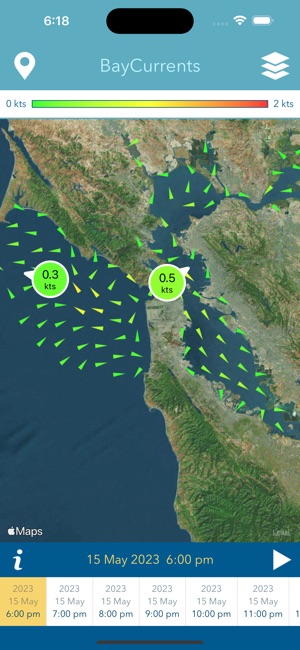
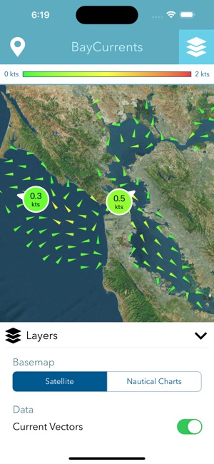
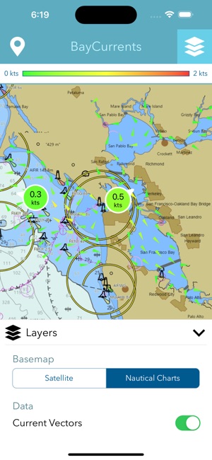
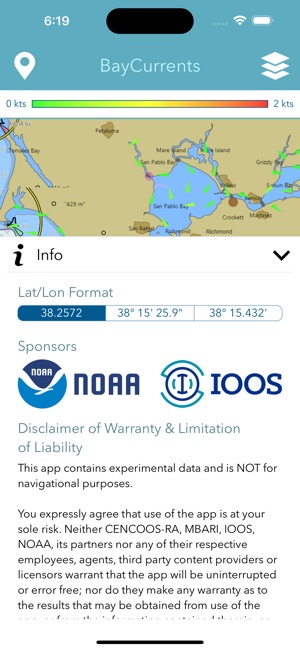
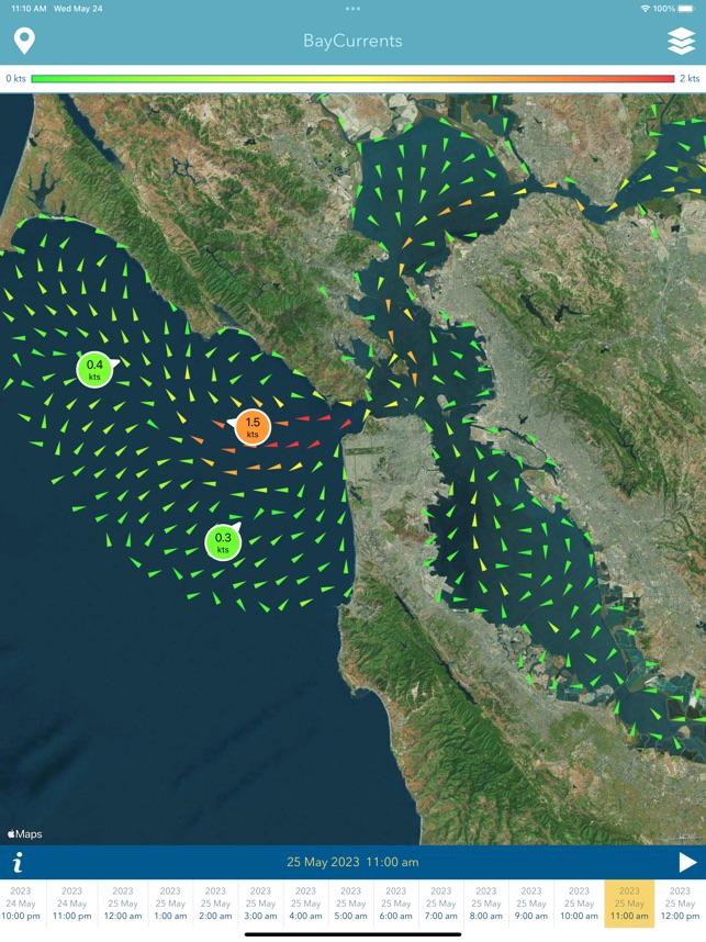
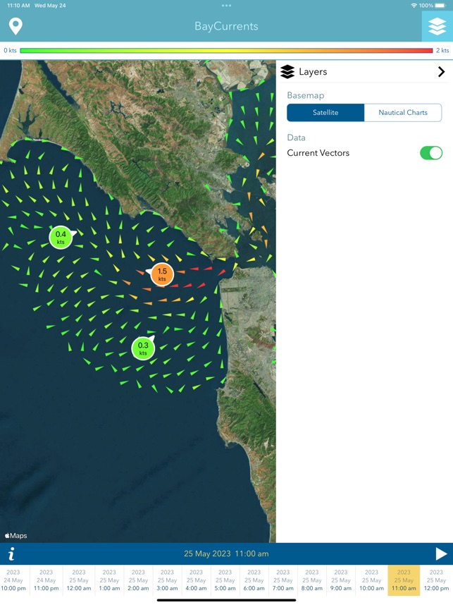
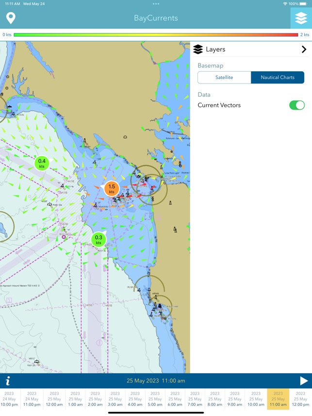
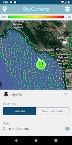
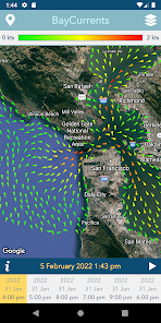
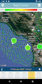
BayCurrents provides visualization of high-resolution surface current data for the San Francisco Bay region. The system downloads a complete vector dataset from a National Oceanic & Atmospheric Administration (NOAA) numerical model, which enables full offline functionality. Its interface presents maps depicting current vector fields at hourly timestamps, encompassing the recent past, the present, and a forecast period of up to 48 hours. The application is designed to support maritime planning by rendering detailed hydrodynamic information.

Evidence & Research Context

  • The app leverages data from the NOAA San Francisco Bay Operational Forecast System (SFBOFS), an established suite of high-resolution hydrodynamic models.
  • The underlying nowcast model integrates real-time observations, including oceanographic high-frequency radar measurements, tides, and wind, to generate its predictions.
  • Associated research details the model's design to provide hourly nowcasts and forecasts of currents and water levels across a 48-hour window to support vessel operations.
  • The model's coordinate system is based on Mercator projection, allowing its output to be directly superimposed on standard navigation charts for contextual analysis.

Intended Use & Scope

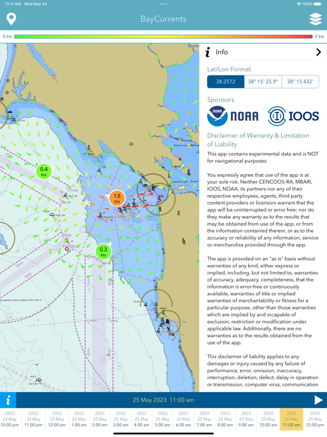
This system is intended for maritime operators, including recreational and professional vessel personnel, for situational awareness and operational planning. Its primary utility is as a supplemental source of hydrodynamic information. BayCurrents displays experimental data and is not a certified navigational tool; it does not replace official navigation charts or instruments for ensuring safe passage.

Studies & Publications

2 publications

Peer-reviewed research associated with this app.

Non-Evaluative Reference

Regional Hydrodynamic Model Outputs of the NOAA San Francisco Bay Operational Forecast System (SFBOFS)

NOAA National Ocean Service et al. (2017) · NOAA National Centers for Environmental Information

Referenced in academic literature; no direct evaluation of the app
This dataset comprises output fields from NOAA Operational Forecast System (OFS) coastal ocean models. The National Ocean Service (NOS) maintains a suite of operational high-resolution hydrodynamic nowcast/forecast systems known as Operational Forecast Systems (OFS). The OFS are implemented in critical ports, harbors, estuaries, the Great Lakes and coastal waters of the United States and provide nowcast and near-term forecast guidance (generally 48 hours) of total water level (without waves), currents, salinity, and water temperature. This dataset includes two types of outputs: (1) time series of gridded (3-dimensional) model fields at up to hourly intervals; and (2) time series of values at specific locations, generally representing observing stations located within the model domain, at up to 6-minute resolution. The format of both types of files is CF-compliant netCDF. Though the OFS models are run 4x daily, for most domains NCEI only preserves one realization of each output time slice (i.e. only the 0-5 hour forecast fields from each run cycle are preserved).
... Read More
Development/Design Paper

A nowcast model for tides and tidal currents in San Francisco Bay, California

Cheng et al. (1988) · Marine Technology Society Conference Proceedings

Describes the research-driven development of this app
National Oceanographic and Atmospheric Administration (NOAA) installed Physical Oceanographic Real-Time System (PORTS) in San Francisco Bay, California to provide observations of tides, tidal currents, and meteorological conditions. PORTS data are used for optimizing vessel operations, increasing margin of safety for navigation, and guiding hazardous material spill prevention and response. Because tides and tidal currents in San Francisco Bay are extremely complex, limited real-time observations are insufficient to provide spatial resolution for variations of tides and tidal currents. To fill the information gaps, a highresolution, robust, semi-implicit, finite-difference nowcast numerical model has been implemented for San Francisco Bay. The model grid and water depths are defined on coordinates based on Mercator projection so the model outputs can be directly superimposed on navigation charts. A data assimilation algorithm has been established to derive the boundary conditions for model simulations. The nowcast model is executed every hour continuously for tides and tidal currents starting from 24 hours before the present time (now) covering a total of 48 hours simulation. Forty-eight hours of nowcast model results are available to the public at all times through the World Wide Web (WWW). Users can view and download the nowcast model results for tides and tidal current distributions in San Francisco Bay for their specific applications and for further analysis.
... Read More

BayCurrents

Free