Rocky Mountains
Expert-developed at a federal agency
App Summary
App Screenshots
Detailed Description
Functionality & Mechanism
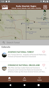
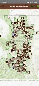
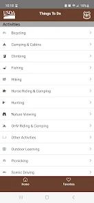
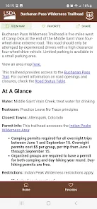
This geographic information and recreational planning tool aggregates data for 17 national forests and 7 national grasslands within the Rocky Mountain Region. The system utilizes an interactive mapping interface that facilitates the exploration and identification of recreational sites, including trails and campgrounds. Key functionalities include a search function for specific locations, zoom and navigation controls, and the ability to download maps for offline use. The platform also disseminates logistical information such as text-based driving directions, safety alerts, site closures, and administrative contact details for individual forest offices.
Intended Use & Scope
This tool is designed for individuals planning recreational visits to national forests and grasslands in the U.S. Rocky Mountain Region. It serves as a centralized resource for trip planning, site discovery, and accessing current safety and operational information. Its scope is limited to the specific federal lands cataloged within the application. Features and availability may vary by device and operating system.
App Information
Category
Evidence Profile
Expert-developed at a federal agency
Platforms
Updated
Mar 2026
© 2025 United States Department of Agriculture
Tags
Developer Links
Privacy PolicyRocky Mountains
Free