iRain UCI
Assessed by researchers — mixed findings
App Summary
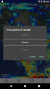
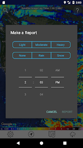
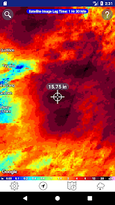
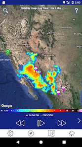
App Screenshots


Detailed Description
Functionality & Mechanism
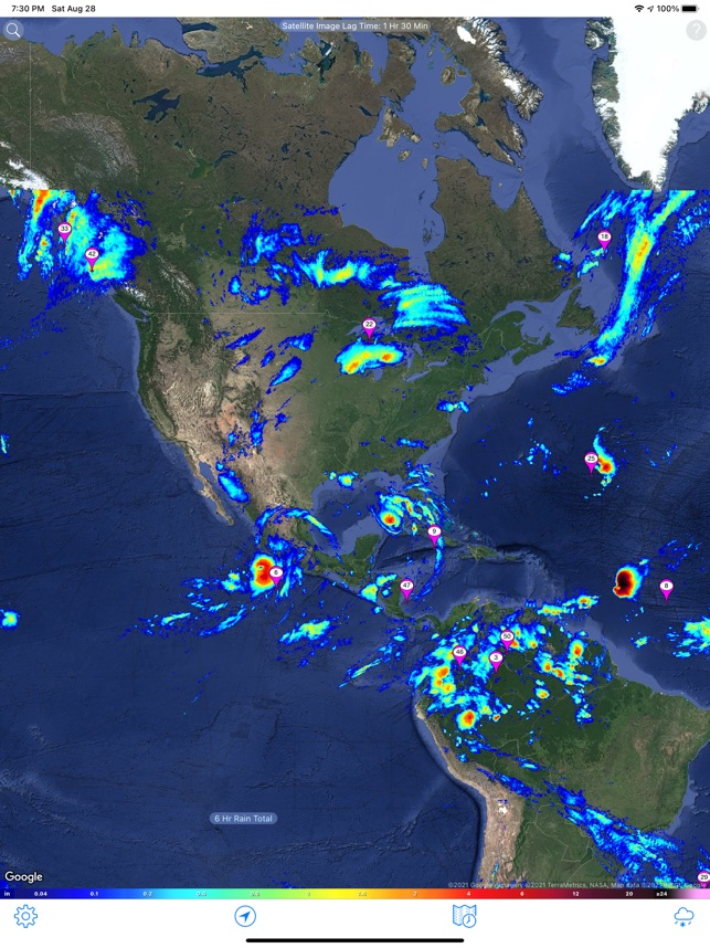
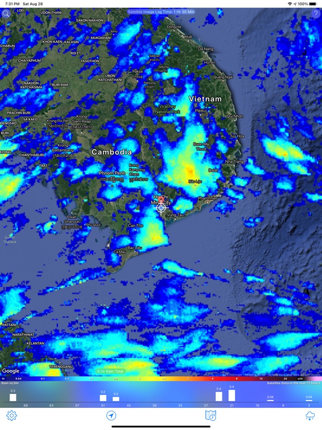
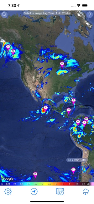
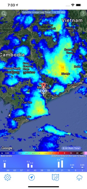
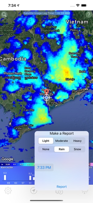
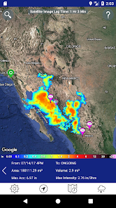
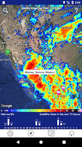
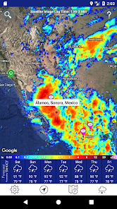
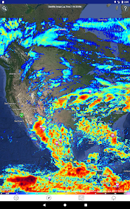
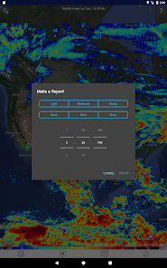
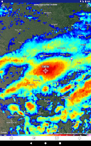
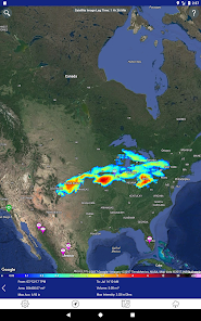
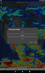
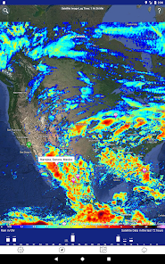
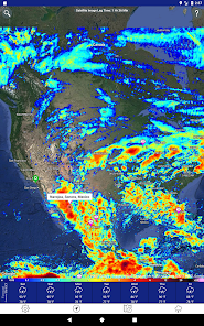
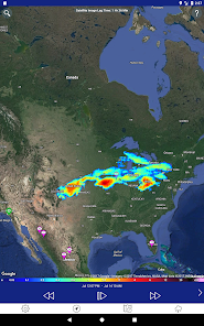
Developed by the University of California Irvine's Center for Hydrometeorology & Remote Sensing (CHRS), the iRain system provides access to real-time, global, high-resolution (~4km) satellite precipitation data. The interface leverages the PERSIANN-CCS algorithm to facilitate visualization of rainfall patterns and tracking of extreme events. An integrated crowdsourcing module enables the submission of local rainfall observations, which are used to supplement the remote sensing data and contribute to ongoing research.
Evidence & Research Context
- The app's data is derived from the PERSIANN family of algorithms, which has been extensively evaluated in scientific literature against ground-based gauge and radar observations.
- The successor PDIR-Now algorithm demonstrated improved rain/no-rain day estimation over the PERSIANN-CCS algorithm (critical success index: 0.53 vs. 0.47, respectively).
- Validation research for extreme events showed the related PDIR-Now algorithm adequately represented precipitation patterns for Hurricane Harvey (correlation coefficient: 0.64) and major European thunderstorms.
- The associated PERSIANN-CDR climate data record, spanning over 30 years, has been validated against ground-based observations for major historical hydrological events.
Intended Use & Scope
This system is intended for researchers, environmental professionals, and the general public for situational awareness of global precipitation. Its primary utility is the visualization and tracking of large-scale hydrometeorological events. The data represents satellite-based estimates and does not substitute for ground-based measurements or official weather forecasts and warnings.
Studies & Publications
Peer-reviewed research associated with this app.
PERSIANN-CCS-CDR, a 3-hourly 0.04° global precipitation climate data record for heavy precipitation studies
Sadeghi et al. (2021) · Scientific Data
Describes the research-driven development of this appPERSIANN Dynamic Infrared¬Rain Rate (PDIR-Now): A Near-Real-Time, Quasi-Global Satellite Precipitation Dataset
Nguyen et al. (2020) · Journal of Hydrometeorology
Referenced in academic literature; no direct evaluation of the appIn the Media
Nguyen Wins WMO Data Prize
UC Irvine's Phu Nguyen and his team at the Center for Hydrometeorology and Remote Sensing developed the iRain app to deliver real-time global rainfall measurements, using the CHRS PERSIANN rainfall datasets. The CHRS PERSIANN websites have been accessed by users from over 200 countries and distributed more than 19 terabytes of rainfall data in 2018. Nguyen won the 2019 World Meteorological Organization Data Prize in recognition of his innovation in developing user-friendly climate databases.
iRain app shares state-of-the-art rainfall estimation
University of California, Irvine engineers developed iRain to provide state-of-the-art satellite rainfall data to the public, using the same precision information available to climate researchers and weather forecasters. "The power of iRain is that it brings state-of-the-art rainfall estimation based on actual observations to anyone, anyplace in the world at any time," says Robert Pietrowsky, director of the U.S. Army Corps of Engineers Institute for Water Resources. The free app compresses data processing time to about an hour and serves users in more than 180 countries through UC Irvine's collaboration with NASA, NOAA, and international satellite agencies.
How much rain did we get? Ask the iRain app created at UCI
UC Irvine engineers developed iRain UCI to provide global rainfall data through satellite processing, using an algorithm created by professor Kuo-lin Hsu that reduces data retrieval time to about an hour. "Using the app to track down how much rainfall there is and the movement of the rainfall is useful for everyone, particularly disaster managers," Hsu said. The free app launched in November 2016 and has attracted approximately 2,000 users in its first few months.
UCI introduces iRain smartphone app
Engineers at the University of California, Irvine developed iRain to provide precision rainfall information to the public, using the same satellite precipitation data that climate researchers and weather forecasters rely on. "The beauty of iRain is that it's an access point for an entire system that detects, tracks, and studies precipitation on our planet," says lead developer Phu Nguyen, assistant adjunct professor of civil & environmental engineering. The free app launched at the United Nations Climate Change Conference in Marrakesh, Morocco, in November 2016.
iRain Mobile App: Using Citizen Science to Support Water Management
The Center for Hydrometeorology and Remote Sensing at the University of California Irvine developed iRain UCI to monitor climate impacts on the water cycle, utilizing citizen science through crowd-sourced precipitation data and the PERSIANN-CCS system developed over two decades. The app facilitates real-time global satellite precipitation observations and allows users to track rainfall events worldwide, which proves particularly useful for emergency planning to warn individuals of dangerous hydrological events. The mobile version supplements the existing web-based iRain tool with support from partners including USACE IWR-ICIWaRM and UNESCO.
App Information
Developer
University of California, IrvineCategory
Evidence Profile
Assessed by researchers — mixed findings
Platforms
Updated
Aug 2023
© 2025 University of California, Irvine