FWAS - Fire Weather Alert System
Published in academic literature
App Summary
App Screenshots


Detailed Description
Functionality & Mechanism
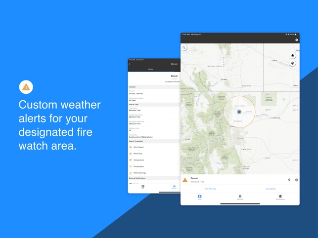
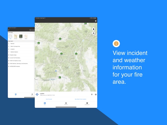
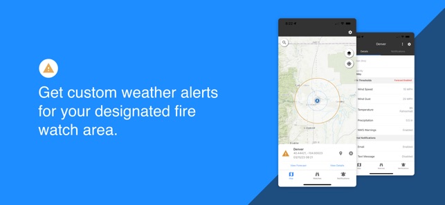
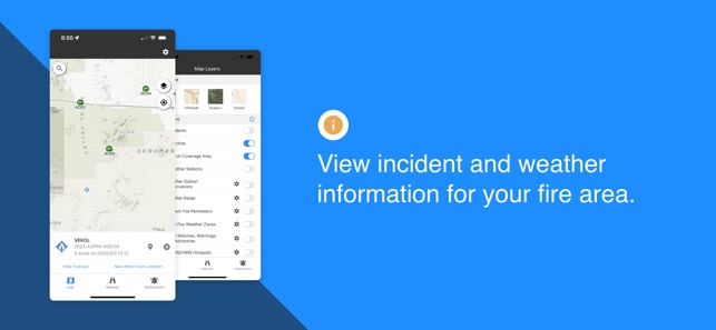
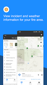
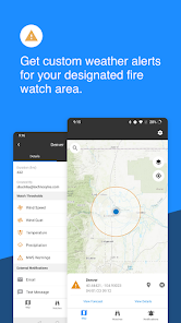
The Fire Weather Alert System (FWAS) is a decision-support platform that delivers real-time, localized meteorological data to operational personnel. The system integrates multiple data streams, including Remote Automated Weather Stations (RAWS), National Weather Service (NWS) forecasts, and NEXRAD radar. Its interface facilitates the designation of a geographic watch area and the configuration of custom alert thresholds for parameters such as wind speed and humidity. The system then automatically monitors conditions and dispatches alerts via in-app, text, or email.
Evidence & Research Context
- The associated research highlights the critical risk posed to firefighters by rapid, unpredictable weather changes that can lead to entrapment.
- The system is designed to mitigate this risk by providing direct, on-the-ground access to real-time weather observations and short-term forecasts.
- FWAS aggregates data from established meteorological technologies, including RAWS, NEXRAD radar, and satellite-based hotspot detection systems (VIIRS/MODIS).
Intended Use & Scope
This system is intended for wildland firefighters and incident management personnel as a real-time situational awareness and decision-support tool. Its primary utility is to provide automated early warnings of hazardous meteorological changes on the fireline. The platform is designed to supplement, not replace, official weather briefings, command decisions, and established safety protocols.
Studies & Publications
Peer-reviewed research associated with this app.
Fire weather alert system mobile app (FWAS): Realtime data could save lives on the fireline
Jones et al. (2024) · Science You Can Use
Referenced in academic literature; no direct evaluation of the appIn the Media
DVIDS - Audio - Forest Service Podcast: Science You Can Use - Fire Weather Alert System Mobile App (FWAS): Realtime data could save lives on the fireline
Jason Forthofer and Natalie Wagenbrenner from the Rocky Mountain Research Station's Missoula Fire Sciences Laboratory developed the Fire Weather Alert System (FWAS) to address deadly weather shifts that threaten firefighters, using a mobile platform that consolidates multiple weather data sources. The FWAS provides firefighters with "individualized, easy-to-use, and timely weather alerts on their phones" during increasingly longer and more intense fire seasons.
Fire Weather Alert System and Wildfire Risk to Communities Resources from the U.S. Forest Service - West Texas Rangelands
The U.S. Forest Service developed the Fire Weather Alert System (FWAS) to support wildland firefighters with timely weather information, using user-set thresholds for alerts and notifications about changing conditions. The app's recent update includes enhanced features such as push notifications, lightning alerts, ground-based lightning detections, and access to NWS spot weather forecasts. FWAS empowers firefighters with accurate weather insights while helping safeguard communities by enabling timely responses to emerging fire threats.
Risk Informed Wildfire Management
The USDA Forest Service Rocky Mountain Research Station developed FWAS Fire Weather Alert System to help land and fire managers navigate the tension between fire's natural ecological role and wildfire risks to communities, using research-based risk analysis and decision support tools. The system addresses how "heavy fuel accumulation coupled with a warmer, drier climate can promote extreme fire behavior that has potential to threaten communities." This Hot Topic resource was created in partnership with the Rocky Mountain Research Station to support wildfire risk management decisions.
FWAS: An Early Warning System For Wildland Firefighters
Jason Forthofer, a Mechanical Engineer at the U.S. Forest Service's Missoula Fire Lab, developed the Fire Weather Alert System (FWAS) to provide wildland firefighters with early warnings about hazardous weather conditions, using user-friendly mobile technology to consolidate technical data from multiple websites. "The idea is that, if you go out on a fire, a firefighter can set their location, define a radius around that area, then you tell the FWAS the kind of hazardous weather features that you want it to be looking for," Forthofer explained. The prototype system automatically monitors weather data and sends phone alerts when dangerous conditions are detected in the firefighter's specified area.
App Information
Category
Evidence Profile
Published in academic literature
Platforms
Updated
Aug 2024
© 2025 United States Department of Agriculture