Earth-Now
Expert-developed at a federal agency
App Summary
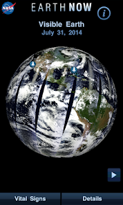
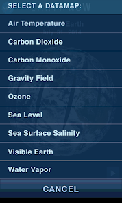
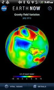
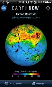
App Screenshots
Detailed Description
Functionality & Mechanism
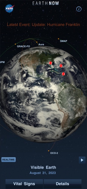
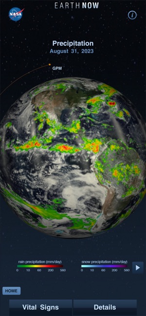
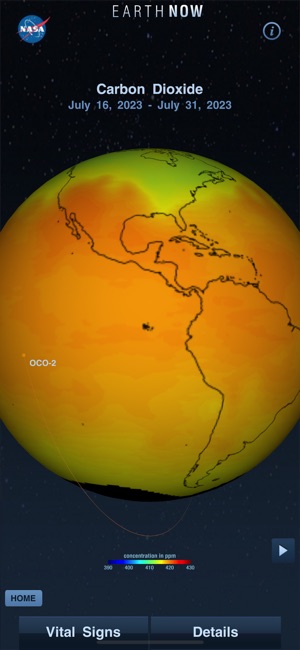
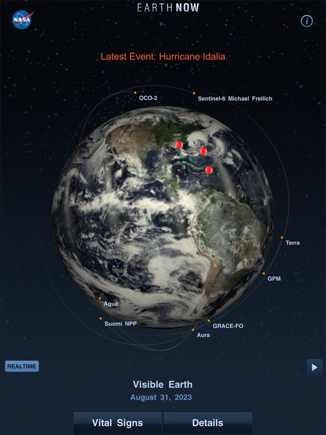
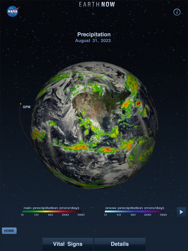
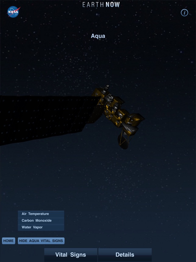
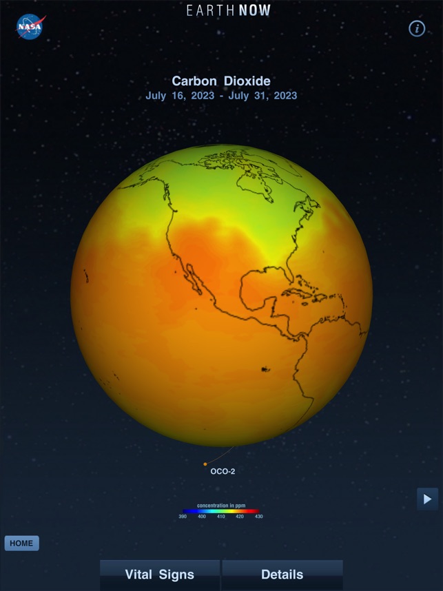
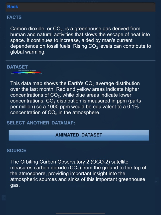
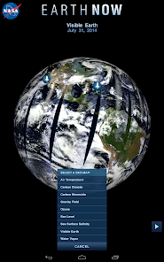
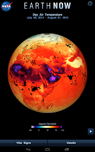
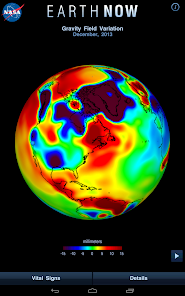
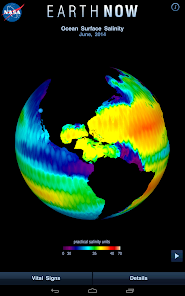
This global climate data visualizer from NASA's Jet Propulsion Laboratory provides near-real-time visualizations of Earth's vital signs. The application aggregates data from a fleet of Earth Science satellites on variables like surface air temperature, carbon dioxide, ozone, and sea level variations. It then projects this information as interactive, "false color" maps onto a rotatable 3D model of the planet, utilizing color-coded legends to indicate the relative strength or weakness of environmental conditions.
Development & Context
- The application was developed by teams at NASA's Jet Propulsion Laboratory to educate the public about Earth's changing climate.
- The news coverage notes the iPhone version of the app was downloaded nearly 250,000 times within seven months of its 2012 launch.
- Initially released for iPhone, an Android version was later developed to expand accessibility to a wider user base.
- Earth-Now is closely integrated with NASA's Webby Award-winning Global Climate Change website, serving as a companion educational resource.
Intended Use & Scope
This application is designed as an educational resource for students, teachers, and members of the public interested in Earth's climate. Its scope is to provide accessible, high-level visualizations of environmental data for public engagement and general informational purposes. The information presented is based on news coverage and developer descriptions, not peer-reviewed research.
In the Media
NASA's 'Earth Now'App Now Available for Android
NASA's Jet Propulsion Laboratory developed Earth Now to provide mobile access to near-real-time global climate data, using 3-D visualizations from NASA's fleet of Earth science satellites. "Since its debut in February 2012, the iPhone version of Earth Now has been downloaded nearly 250,000 times," said Michael Greene, manager of public engagement strategy at JPL. The app displays current surface temperature, carbon dioxide levels, and global sea level data as interactive color maps on a rotatable 3-D Earth model.
NASA's New 'Earth-Now' App: Your World, Unplugged
NASA's Jet Propulsion Laboratory developed Earth-Now to provide near-real-time global climate data visualizations from NASA's fleet of Earth science satellites, displaying the information as interactive color maps over a 3D Earth model. "Since its debut last month, it's already been downloaded nearly 170,000 times," said Michael Greene, manager for public engagement formulation and strategic alliances at JPL. The free iPhone app integrates with NASA's Webby Award-winning Global Climate Change website and was created by JPL's Earth Science Communications and Visualization Technology teams.
App Information
Developer
NASACategory
Evidence Profile
Expert-developed at a federal agency
Platforms
Updated
Dec 2025
© 2025 NASA