EPA AIRNow
Expert-developed at a federal agency
App Summary
App Screenshots
Detailed Description
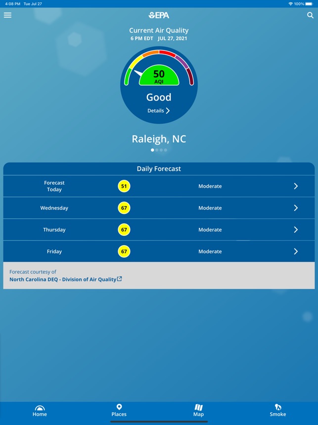
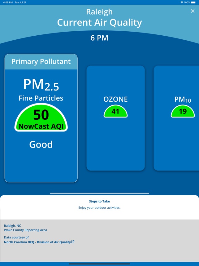
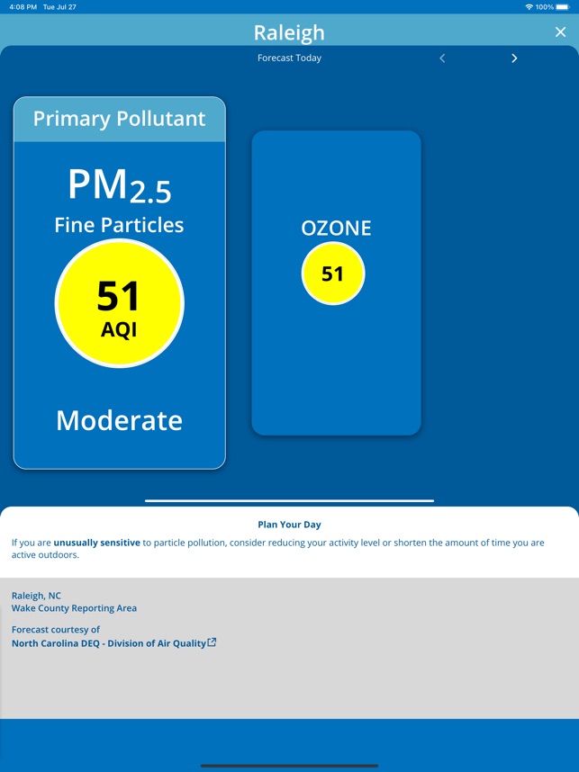
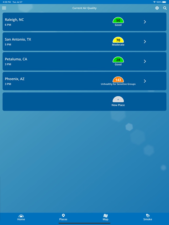
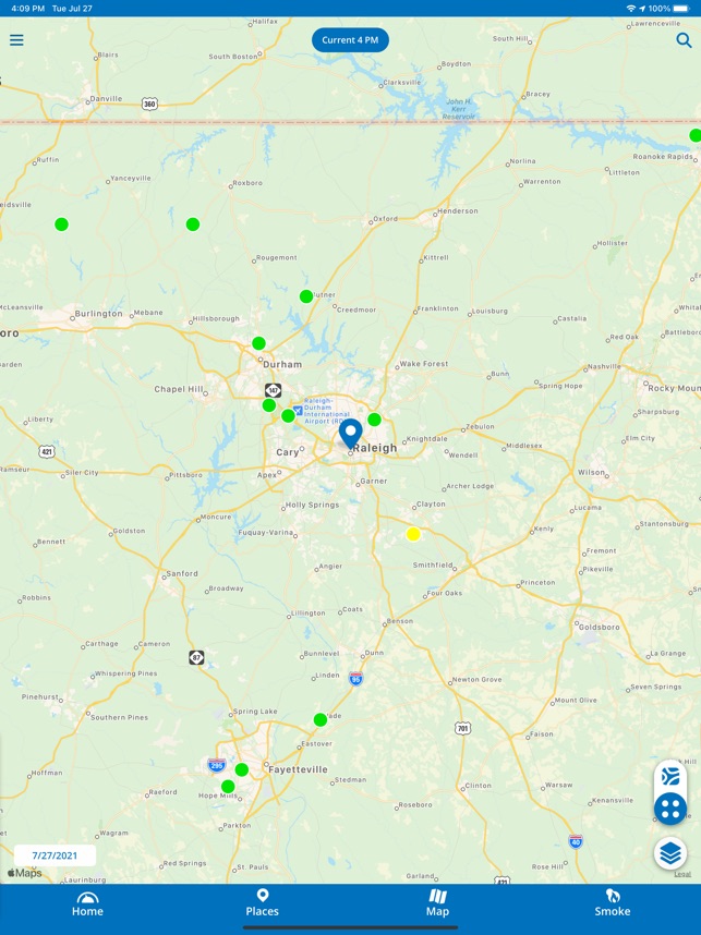
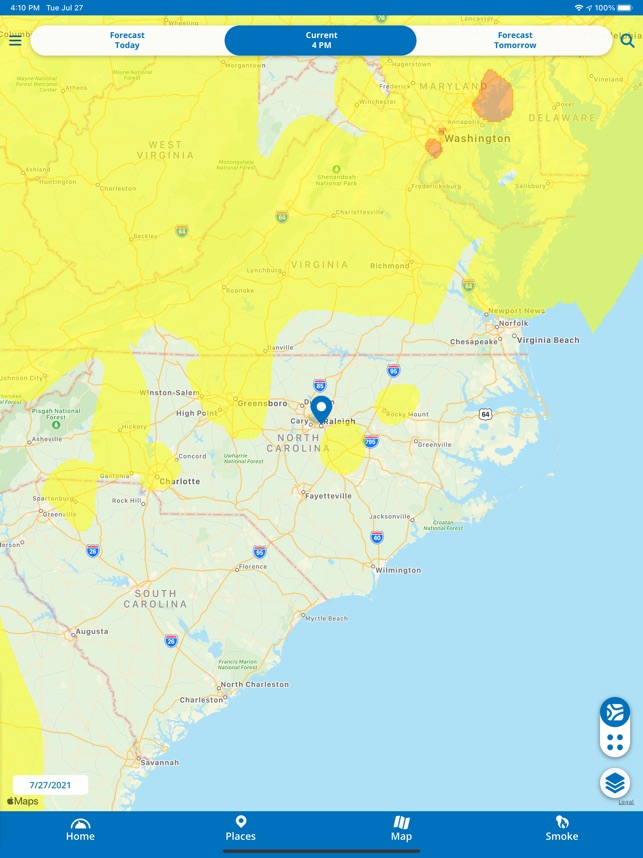
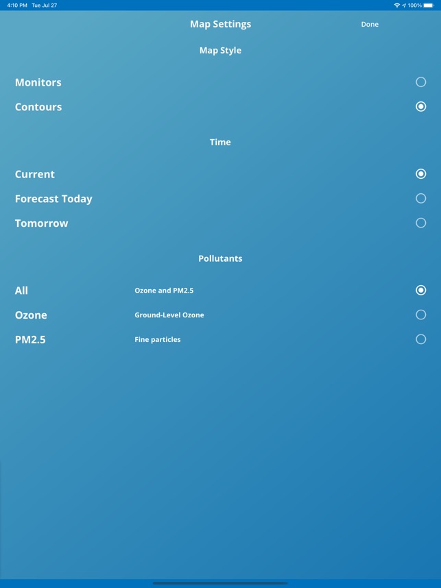
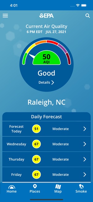
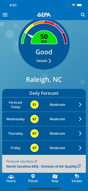
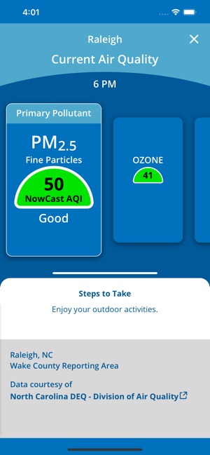
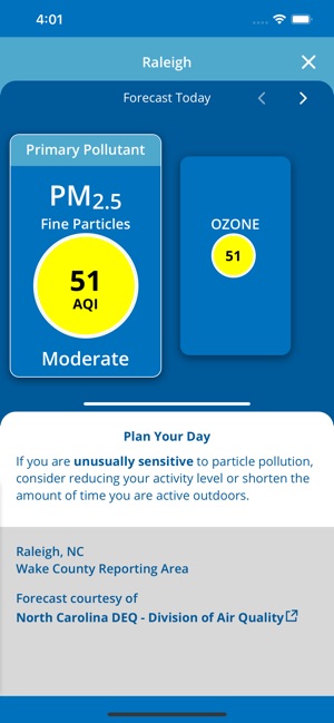
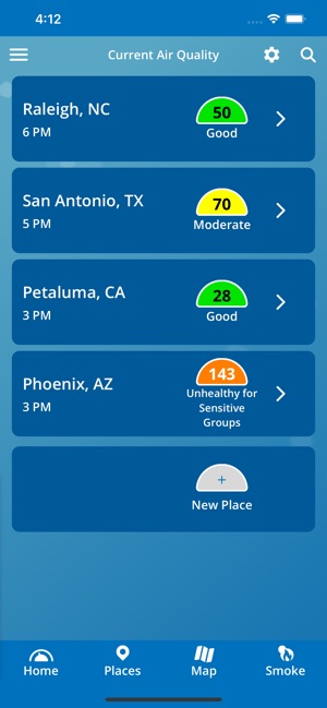
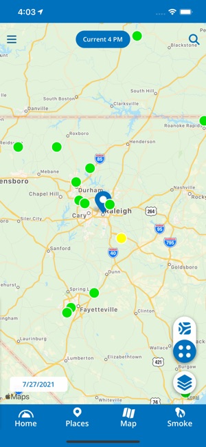
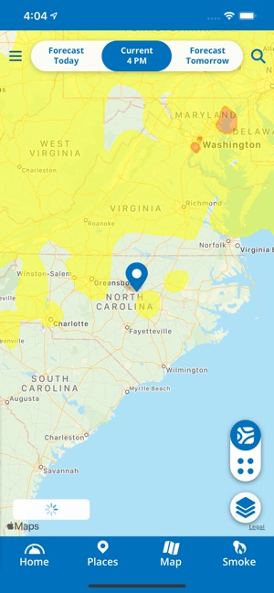
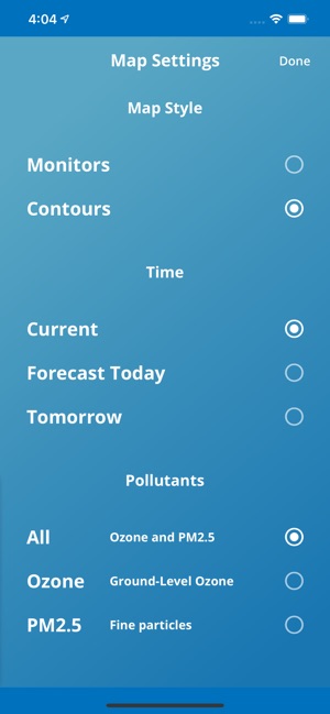
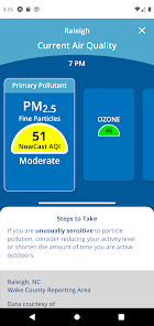
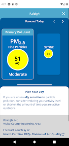
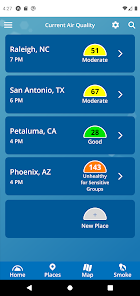
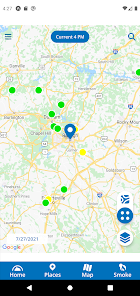
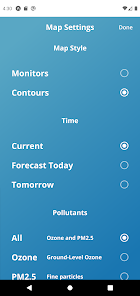
Functionality & Mechanism This public health information tool from the U.S. Environmental Protection Agency (EPA) provides localized air quality data. The app displays current and forecast Air Quality Index (AQI) information for user-selected locations. For its Fire and Smoke Map feature, the platform integrates data from official regulatory monitors, temporary smoke monitors, and crowdsourced sensors. An optional push notification feature alerts users when forecasts reach specific AQI levels, facilitating daily activity planning based on environmental conditions.
Development & Context The news coverage highlights the app's evolution to address public information needs, particularly during wildfires.
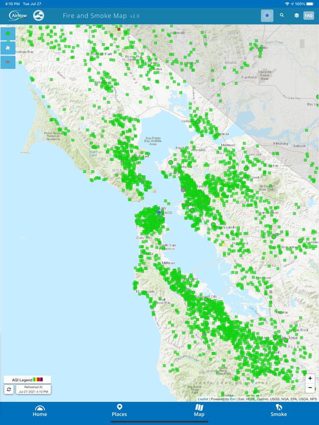
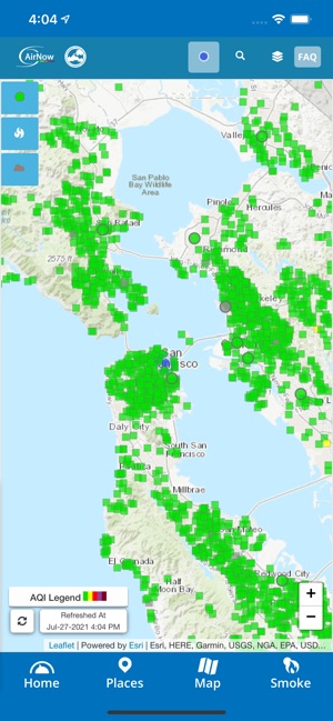
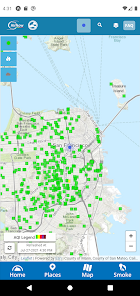
- Developed in partnership with the U.S. Forest Service, the app features a Fire and Smoke Map to display real-time fire locations and smoke plumes.
- To improve data reliability, EPA researchers developed a correction equation that adjusts data from nearly 13,000 crowdsourced sensors for greater accuracy.
- The Fire and Smoke map has been visited over 24 million times since its 2020 launch, indicating significant public adoption and use.
- The app's underlying sensor correction technology has also been leveraged by Google to provide air quality information within Google Maps.
Intended Use & Scope The app is designed for the general public, particularly individuals with health sensitivities to air pollution and those in wildfire-prone regions. It serves as a planning resource for daily activities based on current and forecast air quality. The information is provided for public awareness and does not constitute medical advice or a substitute for official health guidance.
In the Media
Updated EPA's AirNow Mobile Device App Allows Public to Receive Air Quality Forecasts via Push Notification
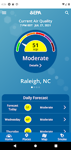
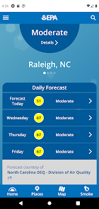
The U.S. Environmental Protection Agency updated its AirNow mobile app to allow users to receive optional push notifications of their local Air Quality Index forecasts for the next day, solving the problem of users having to remember to manually check air quality information. The update enables people to "opt to be notified when the daily forecast reaches an AQI category of their choosing" for up to 10 locations. State and local air agencies provide the AQI forecasts to EPA, which then shares them through the app to help people plan outdoor activities based on predicted ozone and particle pollution levels.
EPA Research Improves Air Quality Information for the Public on the AirNow Fire and Smoke Map
EPA researchers developed the AirNow Fire and Smoke Map to improve air quality information during wildfires, using a correction equation that adjusts data from over 13,000 crowdsourced PurpleAir sensors to match regulatory monitor accuracy. "Air sensors can be useful for providing supplemental air quality information in areas between regulatory monitors," says Chet Wayland, Director of EPA's air quality monitoring programs. The platform has received more than 24 million visits since launching in summer 2020.
Update to EPA's AirNow mobile device app gives public increased access to information about air quality during wildfires
The U.S. Environmental Protection Agency updated its AirNow mobile app to provide users easier access to actionable air quality information during wildfires, incorporating the Fire and Smoke Map jointly developed with the U.S. Forest Service. The enhanced map features a new dashboard that delivers quick access to current Air Quality Index categories, trends showing whether air quality is improving or worsening, and recommended actions based on current conditions. Users can access the Fire and Smoke Map by tapping the Smoke icon in the app's bottom right corner.
App Information
Developer
US Environmental Protection AgencyCategory
Evidence Profile
Expert-developed at a federal agency
Platforms
Updated
Jun 2026
© 2025 US Environmental Protection Agency