mPing
Initial evidence from research studies
App Summary
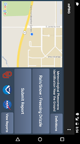
App Screenshots
Detailed Description
Functionality & Mechanism
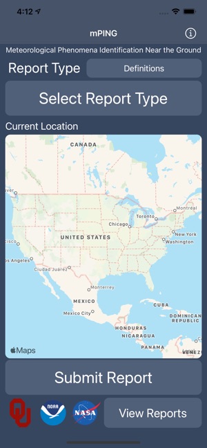
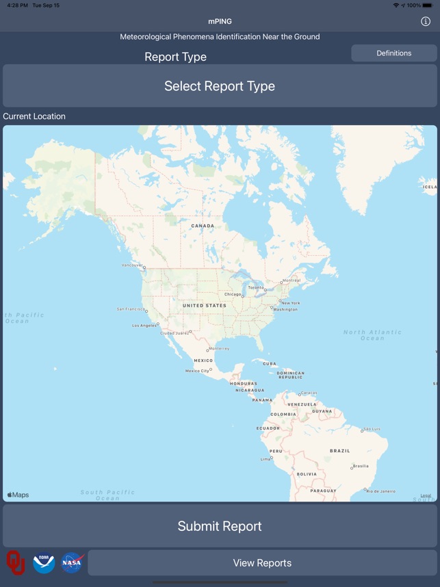
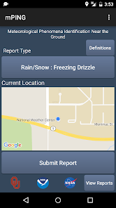
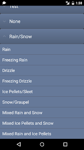
Developed by the NOAA National Severe Storms Laboratory, mPing is a citizen science platform for collecting ground-level precipitation data. The application leverages a device's GPS to geolocate user reports. The interface facilitates the rapid submission of observations by prompting users to select the current precipitation type from a predefined list, including rain, snow, freezing rain, and hail. For hail, the system also captures an estimated size. These geolocated reports are transmitted for meteorological research.
Evidence & Research Context
- The platform was developed to provide human-observed, ground-truth data for validating and refining dual-polarization NEXRAD radar precipitation-type detection algorithms.
- The associated research describes the crowd-sourced data as consistent and accurate, filling observational gaps where automated surface sensors are unavailable or insufficient.
- Data collected via mPing has been utilized to evaluate the accuracy of numerical weather prediction models, including the North American Mesoscale Forecast System.
- An analysis using these citizen science reports facilitated the identification of model biases, specifically an over-forecasting of snow/rain and an under-forecasting of freezing rain/ice pellets.
Intended Use & Scope
mPing is intended for the general public, educators, and students acting as citizen scientists to contribute to meteorological research. Its sole function is to collect user-submitted observations of ground-level precipitation. The application does not provide weather forecasts, warnings, or personal safety alerts. Users must consult official sources for operational weather information and guidance.
Studies & Publications
Peer-reviewed research associated with this app.
Verifying Forecast Precipitation Type with mPING
Elmore et al. (2015) · Weather and Forecasting
Successfully validated crowd-sourced observations for assessing precipitation type forecast accuracy.
mPING: Crowd-sourcing weather reports for research
Elmore et al. (2014) · Bulletin of the American Meteorological Society
Describes the research-driven development of this appIn the Media
mPING awarded for help in operational meteorology
NOAA's National Severe Storms Laboratory and the University of Oklahoma developed mPING to improve weather forecasting by significantly increasing ground-truth weather observations from citizen scientists. The National Weather Association awarded the mPING team the Larry R. Johnson Special Award "for creating the mPING applications which improved forecast operations by significantly increasing the number, quality, and type of ground-truth weather observations." The free app was featured in Scientific American's list of 8 Apps That Turn Citizens into Scientists.
Weather Reports from Citizens Provide Research Input
NOAA's National Severe Storms Laboratory developed mPing to gather ground-level weather reports from citizen scientists, using a free smartphone app that allows users to submit precipitation observations every 30 seconds. Research scientist Kim Elmore found that "people can clearly discriminate between freezing rain and rain and freezing rain and ice pellets," with studies showing only 17 percent of disagreeing observations were actually rain while 60 percent were ice pellets. The app helps researchers develop new radar technologies and enables the National Weather Service to fine-tune forecasts since weather radars cannot "see" conditions at ground level.
NSSL Projects: mPING
The NOAA National Severe Storms Laboratory developed mPING to collect public weather reports for research, using a free smartphone app that allows users to report meteorological phenomena occurring at ground level. The app was created through a partnership between NSSL, the University of Oklahoma and the Cooperative Institute for Severe & High-Impact Weather Research & Operations, and was included in Scientific American's list of 8 Apps That Turn Citizens into Scientists. Weather radars cannot "see" at the ground, so NOAA uses mPING reports to fine-tune forecasts and develop new radar technologies.
mPING Weather App Goes Global
Developers from NOAA's National Severe Storms Laboratory and the University of Oklahoma's Cooperative Institute for Mesoscale Meteorological Studies expanded mPING globally to allow citizen scientists worldwide to submit weather observations, announcing the upgrade during the American Meteorological Society's annual meeting in New Orleans. Since its December 2012 launch, mPING has received nearly a million weather reports on U.S.-based events, and "these are exciting times" as the improvements make the app "even more useful for researchers and forecasters as well as anyone who wants to know about the weather," said Kim Elmore, CIMMS research scientist leading the project. The updated interface now features multi-language support with 11 languages available and allows NOAA National Weather Service forecasters to access mPING observations directly on their office workstations.
NOAA, University of Oklahoma introduce mPING app to help track weather as it happens
NOAA and the University of Oklahoma developed mPING to collect public weather reports through a smartphone app that helps meteorologists track precipitation as it happens at ground level. "It's nice to have an extra set of eyes in the field, and this app and the observations that come in can be really beneficial to meteorologists," said WNCT chief meteorologist Jerry Jackson. Scientists compare these field reports to radar detections to improve forecasting technologies since radars cannot "see" at ground level.
NSSL Launches iPhone and Android Apps to collect precipitation reports from the public
The NOAA National Severe Storms Laboratory (NSSL), in partnership with the University of Oklahoma, launched mPing to collect anonymous precipitation reports from the public using iPhone and Android devices. NSSL researchers compare these reports with radar data to develop new radar and forecasting technologies that determine whether snow, rain, ice pellets, mixtures or hail is falling. NSSL hopes to build a valuable database of tens of thousands of observations from across the U.S.
App Information
Developer
University of OklahomaCategory
Evidence Profile
Initial evidence from research studies
Platforms
Updated
Sep 2020
© 2025 University of Oklahoma