Smart Sea Level Sensors
Published in academic literature
App Summary
App Screenshots
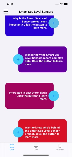
Detailed Description
Functionality & Mechanism
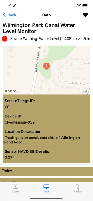
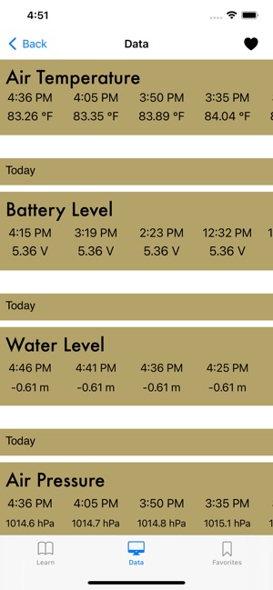
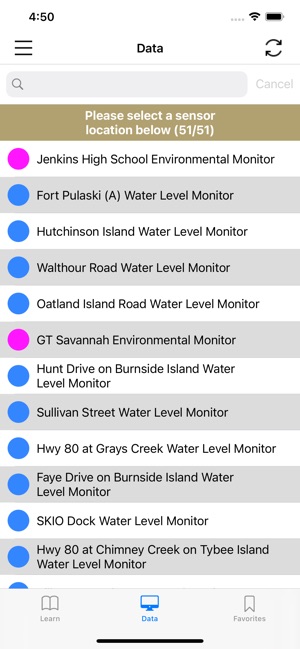
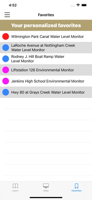
Developed by Georgia Tech in partnership with Chatham County, this system provides public access to a high-density network of coastal water level sensors. The interface presents real-time and historical data—including water level, air temperature, and pressure—from over 50 individual sensors. A primary data module facilitates visualization of recent observations, while an educational module provides context on sea level rise and project methodology. Users can designate specific sensors as 'favorites' for streamlined monitoring of key locations.
Evidence & Research Context
- The sensor network's design is based on a multi-objective optimization method detailed in associated research from the development team.
- This placement methodology integrates traditional sensor network performance metrics with flood-specific parameters, including hazard estimations, infrastructure exposure, and social vulnerability indices.
- The optimization workflow reduced the set of potential new sensor locations to 1.3% of the full solution set, enabling targeted and effective network expansion.
- This data-driven approach is intended to generate detailed and accurate hyperlocal water level information for flood risk assessment and mitigation in coastal communities.
Intended Use & Scope
This tool is intended for the general public, government officials, and local business owners for real-time situational awareness of hyperlocal water levels. It functions as a direct data visualization platform for monitoring current conditions. The app is not a predictive flood forecasting model or an official emergency alert system; users must consult official sources for warnings and evacuation orders.
Studies & Publications
Peer-reviewed research associated with this app.
Locating real-time water level sensors in coastal communities to assess flood risk by optimizing across multiple objectives
Tien et al. (2023) · Communications Earth & Environment
Referenced in academic literature; no direct evaluation of the appIn the Media
Smart Sea Level Sensors
The Chatham Emergency Management Agency, City of Savannah officials, and Georgia Tech scientists developed Smart Sea Level Sensors to provide real-time coastal flooding data across Chatham County, using a network of internet-enabled sensors. The partnership aims to "provide real-time information about water levels across Chatham County to aid in emergency planning and response during episodes of flooding associated with storms, king tides, and other environmental events." The collected data also creates a unique dataset for scientists and regional planners to assess short- and long-term sea level rise risks.
Low-cost sensors help Savannah, Georgia, track flooding in real time
Georgia Tech computer science researcher Russell Clark developed Smart Sea Level Sensors to address the lack of neighborhood-level flood monitoring in Savannah, Georgia, using about 50 low-cost sensors installed on bridges, docks, and canals. "Our objective is to monitor as closely as we can and as extensively as we can the water levels across the Chatham County area, paying specific interest to critical infrastructure," Clark says. The real-time data is available online and guides emergency planning as sea levels rise and storms intensify.
A leading scientist's transition from climate science to solutions
Dr. Kim Cobb at Georgia Tech transitioned from climate research to developing climate solutions after devastating coral reef losses, leading to her work on Smart Sea Level Sensors to address coastal flooding impacts. "I decided to go 'all in' on climate solutions, personally and professionally," Dr. Cobb said, following 2017 and 2018 flooding events along the Georgia coast that brought climate change impacts closer to home.
Water Monitoring Project Makes Savannah a World Leader
The city of Savannah, Chatham County Emergency Management, and Georgia Tech developed Smart Sea Level Sensors to monitor flooding risks, using wireless technology that transmits water level readings every five minutes. According to Russell J. Clark from Georgia Tech, "We are able to look at all the data and give alerts when a location's water is rising or about to flood." The partnership has installed 42 sensors across bridges, coastal areas, and marinas with a $100,000 grant, creating what experts call the world's highest density of water monitoring sensors.
App Information
Developer
Georgia TechCategory
Evidence Profile
Published in academic literature
Platforms
Updated
May 2021
© 2025 Georgia Tech
Tags
Developer Links
Privacy PolicySmart Sea Level Sensors
Free