Soil Explorer
Published in academic literature
App Summary
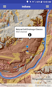
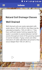
App Screenshots
Detailed Description
Functionality & Mechanism
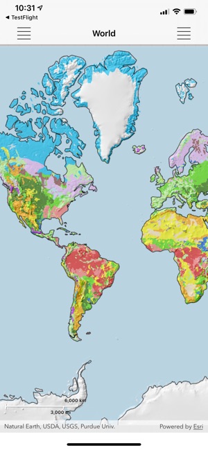
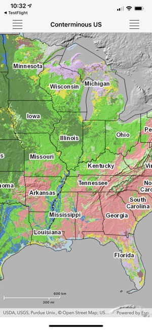
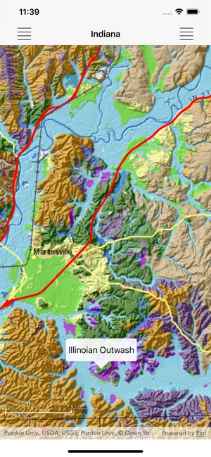
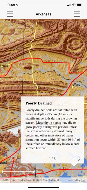
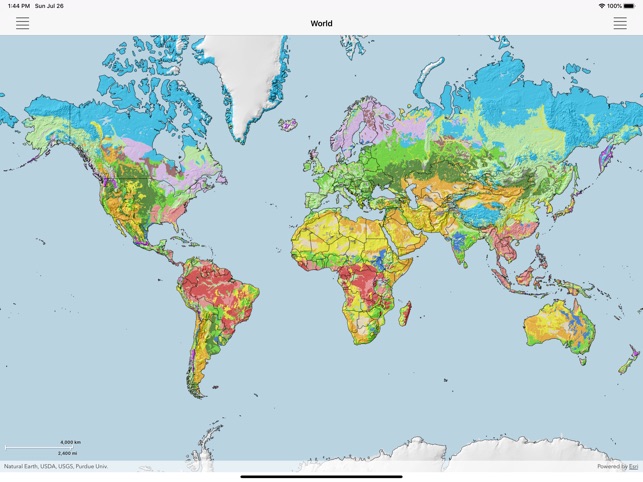
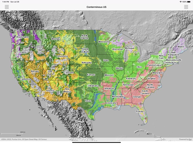
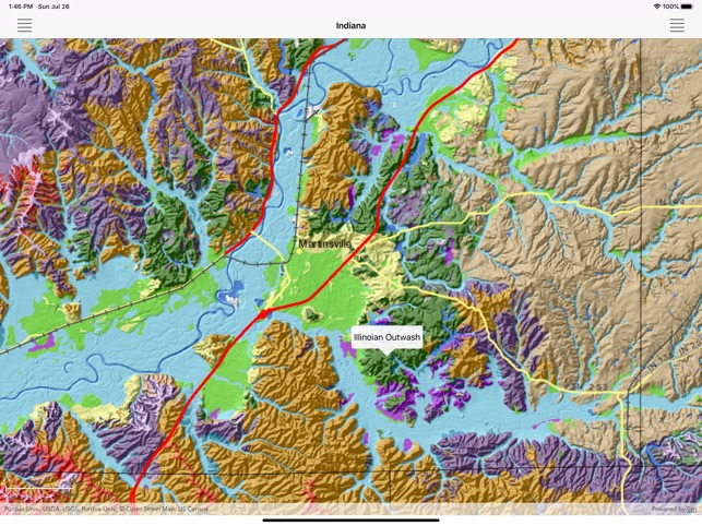
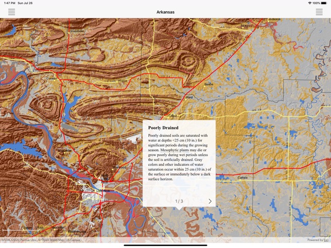
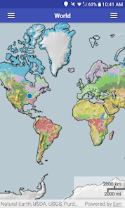
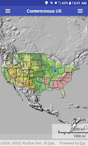
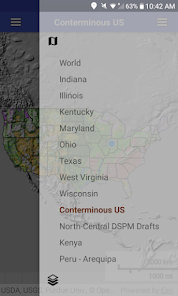
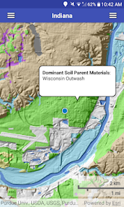
Developed by Purdue University, Soil Explorer provides interactive access to geospatial soil data from the USDA Natural Resources Conservation Service and U.S. Geological Survey. The system leverages a layered interface where individual soil attributes, such as parent material or soil order, are presented on discrete thematic maps. This design facilitates the rapid toggling between data layers, enabling detailed analysis of complex spatial relationships among various soil properties. The platform covers the conterminous U.S. and provides global-scale maps for broader context.
Evidence & Research Context
- The system's maps are interpretive visualizations of the gSSURGO database, a rasterized, high-resolution dataset derived from the U.S. National Cooperative Soil Survey.
- The platform's design, detailed in a descriptive paper, focuses on presenting single soil attributes in discrete layers to enhance accessibility for both novice and expert users.
- The app has been utilized as a pedagogical tool to deliver virtual field trips in a university advanced pedology course (N=7).
- An evaluation of this virtual format found students rated it as informative and appropriate, though an in-person format was preferred in the advanced course setting.
Intended Use & Scope
This platform is intended as an educational and professional reference tool for students, educators, and researchers in soil science, geology, and environmental science. Its primary utility is the visualization and interpretation of national soil survey data. The system does not generate novel predictions or collect field data; for regulatory or official survey purposes, direct consultation with primary USDA NRCS sources is required.
Studies & Publications
Peer-reviewed research associated with this app.
Virtualizing soil science field trips
Schulze et al. (2023) · Natural Sciences Education
Virtual field trips successfully replaced in-person trips using 360° photos, videos, and interactive platform features.Soil Explorer - Impressive Interpretations from the USA Soil Survey Maps
Miller et al. (2018) · Geophysical Research Abstracts
Referenced in academic literature; no direct evaluation of the appIn the Media
The latest in soil tech: Purdue researchers study soil, bring innovations to market
Purdue University researchers developed Soil Explorer as an educational tool for understanding soil properties, using highly detailed maps viewable on tablet devices. The application supports teaching and learning at the university level by allowing users to zoom in and see details or quickly zoom out to see map overviews. By switching between various maps and zoom levels, users gain a better understanding of the complex interactions between soil properties and the landscapes where they occur.
Precision Soil Maps: Moving Beyond Soil Survey
Purdue University developed Soil Explorer to move beyond traditional soil surveys by integrating novel sensor information into spatiotemporal soil mapping and monitoring applications. Ackerson's research focuses on "developing and testing novel soil sensing systems for improved measurement of soil properties" and creating systems for precision agriculture applications. The tool supports digital soil mapping research in the Wabash Heartland Innovation Network region.
Purdue mapping technology could help farmers better understand their soil's functionality
Purdue University associate professor Phillip R. Owens developed functional soil mapping technology to provide farmers with detailed visual information about soil functionality and productivity, using algorithms that capture relationships between landscape, water and soil development. Owens explains that unlike basic USDA soil surveys, "these functional maps show properties like organic carbon content, clay content, the location of water tables, the native nutrient potential, catatonic exchange and more." The technology is available for licensing through the Purdue Office of Technology Commercialization.
App Information
Developer
Purdue UniversityCategory
Evidence Profile
Published in academic literature
Platforms
Updated
Apr 2024
© 2025 Purdue University