SOS Explorer
Assessed for usability and quality
App Summary
App Screenshots


Detailed Description
Functionality & Mechanism
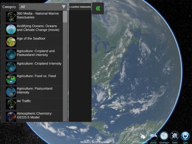
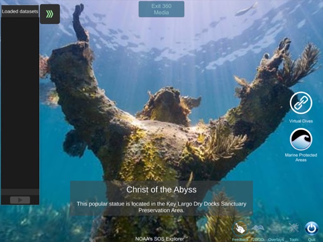
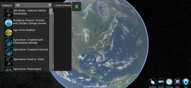
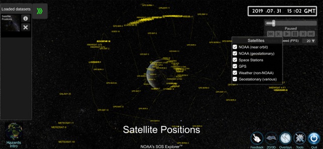
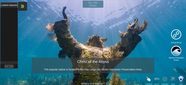
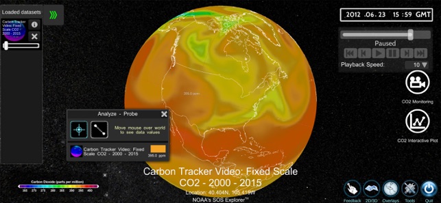
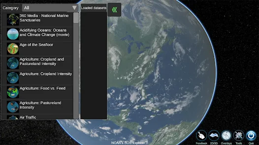
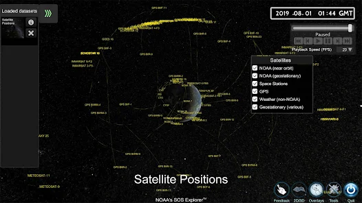
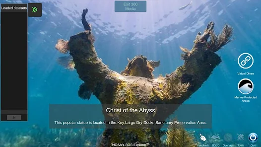
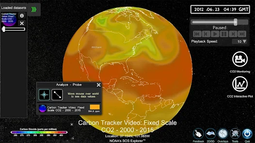
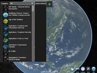
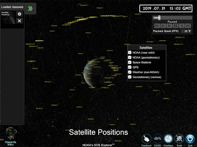
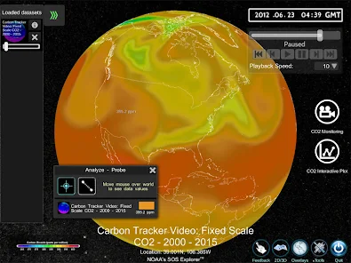
Developed by the National Oceanic and Atmospheric Administration (NOAA), SOS Explorer is a data visualization platform that renders scientific datasets onto an interactive, three-dimensional virtual globe. The system ports content from the large-format Science On a Sphere® exhibit to desktop and mobile devices. Sessions involve navigating over 100 curated datasets spanning climatology, oceanography, and planetary science. The interface facilitates exploration through animated visualizations, user-guided tours, analysis tools, and the ability to toggle between global and flat map projections.
Evidence & Research Context
- An evaluation (N=691) of the parent Science On a Sphere® exhibit found the 3D format effective for comprehension, with 82% of visitors reporting it changed their understanding of data compared to 2D maps.
- The mobile application is utilized in National Science Foundation-funded research to develop and test pedagogical methods for enhancing student data literacy and critical thinking skills in classroom settings.
- The platform's design is grounded in educational research demonstrating that 3D visualization is superior to static 2D maps for teaching dynamic Earth science concepts, such as atmospheric and oceanic circulation.
Intended Use & Scope
The system is intended for educators, students, and the general public as a pedagogical tool to improve data literacy and conceptual understanding of complex Earth systems. Its primary utility is data visualization and education, not primary data analysis or forecasting. The platform visualizes curated datasets; for novel research or predictive modeling, consultation with primary data sources and specialized analytical software is required.
Studies & Publications
Peer-reviewed research associated with this app.
Walking the Last Mile: NOAA's Science On a Sphere Project on Making Data Digestible for Educators and Students
McDougall et al. (2023) · AGU Fall Meeting Abstract
Referenced in academic literature; no direct evaluation of the appNOAA's SOS Explorer's Quest toward Creating a Data Visualization Toolbox for Teachers
Peddicord et al. (2022) · AMS Meeting Abstract
Referenced in academic literature; no direct evaluation of the appIn the Media
NOAA's Free SOS Explorer Offers Earth and Space Datasets
NOAA developed SOS Explorer to provide free access to Earth and space data visualizations on personal devices, utilizing real-time data feeds from NOAA and NASA with more than 175 datasets. "SOSx is the best option for people who want to dive into Earth and space data visualizations on their own computers or in the classroom," says Beth Russell, Senior Program Coordinator for the Science On a Sphere Program. The app, which transitioned from a paid Windows tool to free availability across Windows, Android, and iPhone platforms since 2019, features 4K resolution graphics and touchscreen compatibility.
Immerse yourself in Earth and space: Get SOS Explorer
NOAA's Science On a Sphere team developed SOS Explorer to help students, educators, and curious people explore Earth and space data on a virtual globe using their personal computers. "SOSx is the best option for people who want to dive into Earth and space data visualizations on their own computers or in the classroom," says Beth Russell, Senior Program Coordinator for the Science On a Sphere Program. The software displays more than 175 datasets with 4K resolution graphics and was released as free software in June 2024.
New NOAA App Brings Earth and Space Animations to Your Phone
NOAA, CIRES, and CIRA scientists in NOAA's Global Systems Laboratory developed SOS Explorer Mobile to bring earth science stories to smartphones, using visually stunning animations of satellite data and numerical models on a virtual globe. "I use my phone to show sea surface currents, clouds, Saturn's rings, and much more to anyone who will let me," said Kate Semmens, Science Director at Nurture Nature Center. The app offers more than 115 datasets from NOAA, NASA, and academic institutions with interactive features including zooming, rotating, and time-scrolling capabilities.
New NOAA app brings earth and space animations to your phone
NOAA, CIRES, and CIRA scientists in NOAA's Global Systems Division developed SOS Explorer Mobile to bring earth science stories to smartphones, using visually stunning animations of satellite data and numerical model outputs displayed on a virtual globe. Users can interact with streaming data visualizations by zooming, rotating, scrolling through time, taking guided tours through datasets, and watching embedded educational videos. The app represents the latest addition to a family of data-viewing tools built on the foundation of Science On a Sphere®, which features in more than 160 museums worldwide.
Learn More About Earth's Ecology and Weather With NOAA's New App
The National Oceanic and Atmospheric Administration (NOAA) developed SOS Explorer as a mobile version of its museum-based "Science On a Sphere" system, bringing environmental data visualization to smartphones and tablets. The free iOS and Android app displays animated datasets including recent hurricane seasons, bird migration, earthquake activity, climate change models, and even Saturn's rings on a virtual globe interface. Users can zoom in on different regions and customize their experience based on their interests in earth science topics.
New NOAA App Brings Earth and Space Animations to Your Phone
NOAA, CIRES, and CIRA scientists developed SOS Explorer Mobile to help educators and students understand Earth science through streaming data visualizations on a virtual globe. The app displays animations of satellite observations and numerical model outputs, allowing users to interact by "zooming in and out, rotating, scrolling through time, taking guided tours through datasets, and watching embedded educational videos." Kate Semmens, Science Director at Nurture Nature Center, said "I use my phone to show sea surface currents, clouds, Saturn's rings, and much more to anyone who will let me."
App Information
Developer
University of Colorado BoulderCategory
Evidence Profile
Assessed for usability and quality
Platforms
Updated
Apr 2026
© 2025 University of Colorado Boulder