AppsFromResearch
StraboField icon

StraboField

Evidence Tier:DOCUMENTED

Published in academic literature

For:Researchers & AcademicsIndustry Professionals

App Summary

StraboField is a digital data collection app for geologists to record, map, and organize field observations for disciplines like structural geology and sedimentology. The associated research describes its data system, which was designed with geologists to organize complex observations using a flexible structure of spatial 'spots' and conceptual 'tags'. The authors conclude that by standardizing data collection and sharing, the system enables better research communication and facilitates new types of scientific inquiry.

App Screenshots

StraboField screenshot 1 of 38StraboField screenshot 2 of 38StraboField screenshot 3 of 38StraboField screenshot 4 of 38StraboField screenshot 5 of 38StraboField screenshot 6 of 38StraboField screenshot 7 of 38StraboField screenshot 8 of 38StraboField screenshot 9 of 38StraboField screenshot 10 of 38StraboField screenshot 11 of 38StraboField screenshot 12 of 38StraboField screenshot 13 of 38StraboField screenshot 14 of 38StraboField screenshot 15 of 38StraboField screenshot 16 of 38StraboField screenshot 17 of 38StraboField screenshot 18 of 38StraboField screenshot 19 of 38StraboField screenshot 20 of 38StraboField screenshot 21 of 38StraboField screenshot 22 of 38StraboField screenshot 23 of 38StraboField screenshot 24 of 38StraboField screenshot 25 of 38StraboField screenshot 26 of 38StraboField screenshot 27 of 38StraboField screenshot 28 of 38StraboField screenshot 29 of 38StraboField screenshot 30 of 38StraboField screenshot 31 of 38StraboField screenshot 32 of 38StraboField screenshot 33 of 38StraboField screenshot 34 of 38StraboField screenshot 35 of 38StraboField screenshot 36 of 38StraboField screenshot 37 of 38StraboField screenshot 38 of 38

Detailed Description

Functionality & Mechanism

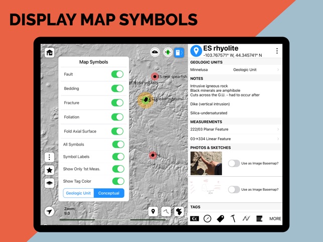
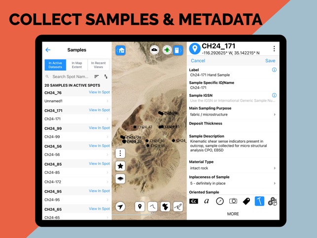
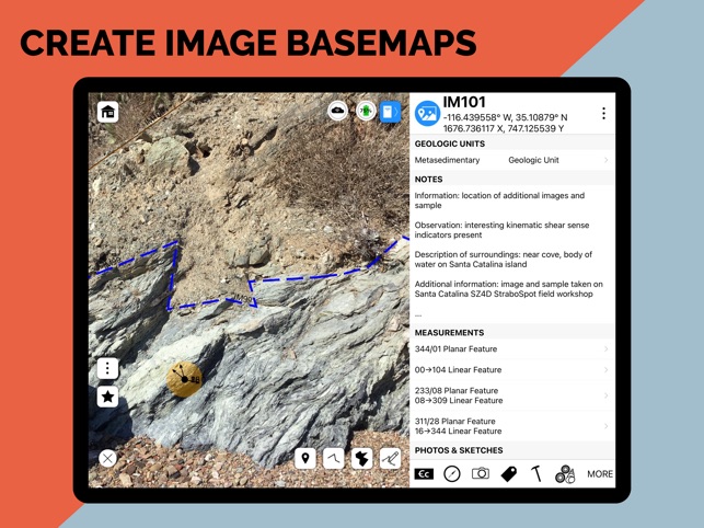
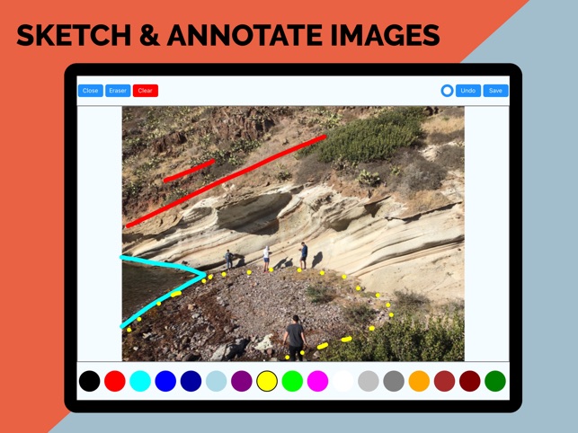
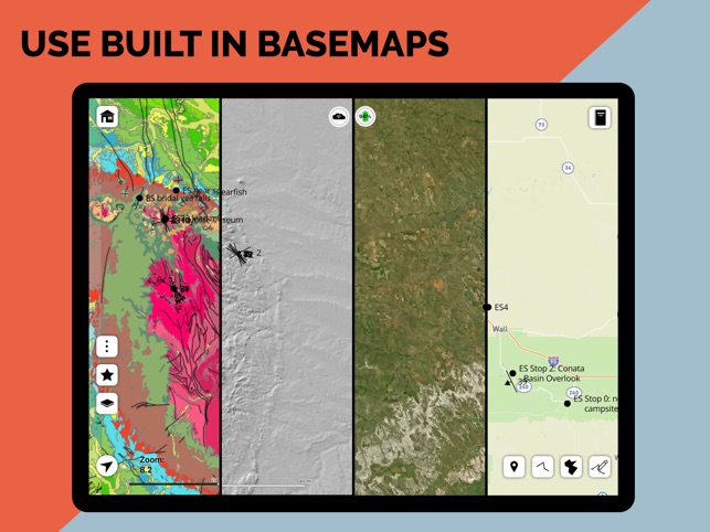
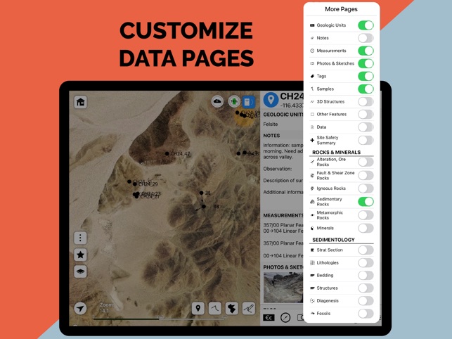
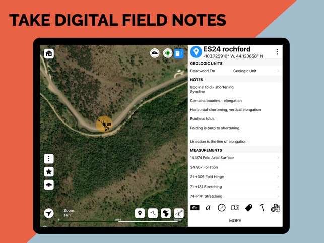
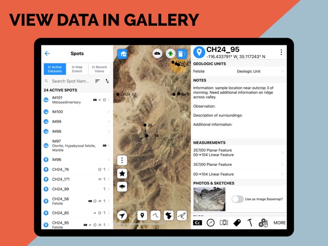
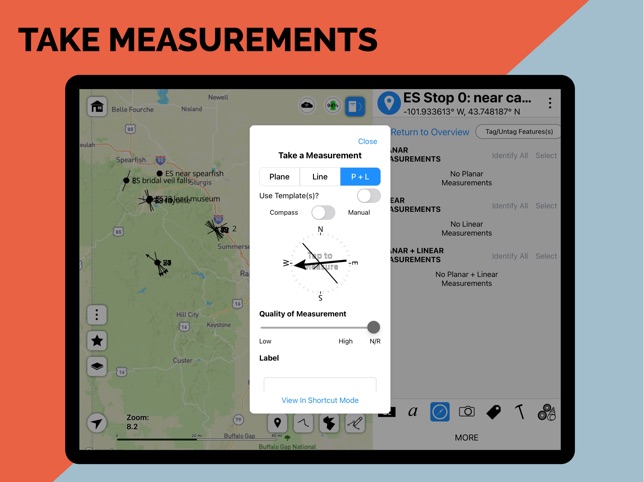
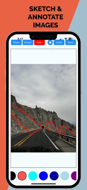
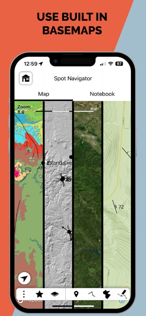
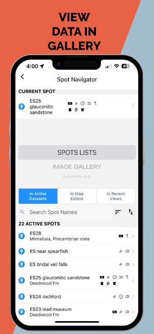
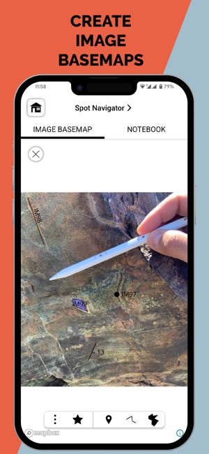
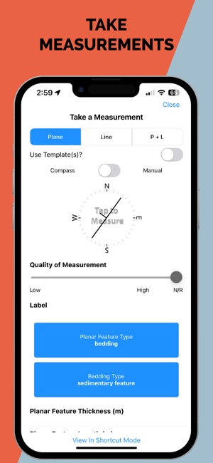
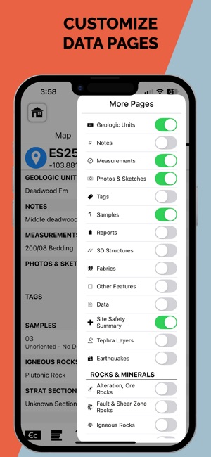
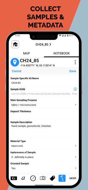
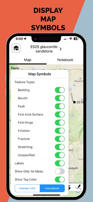
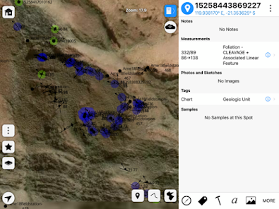
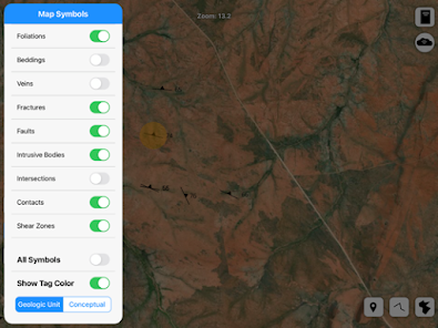
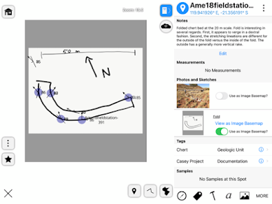
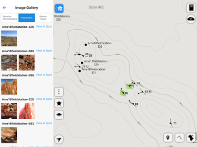
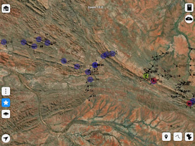
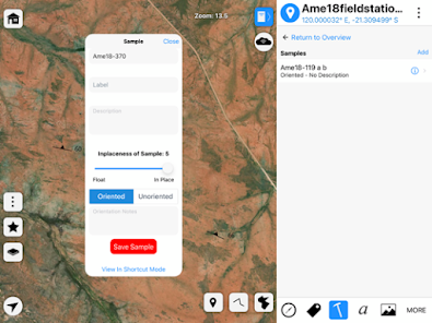
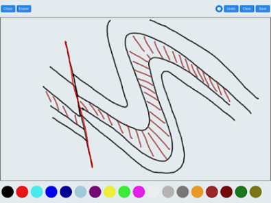
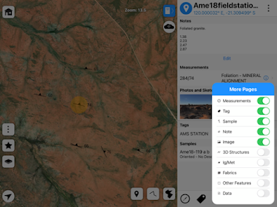
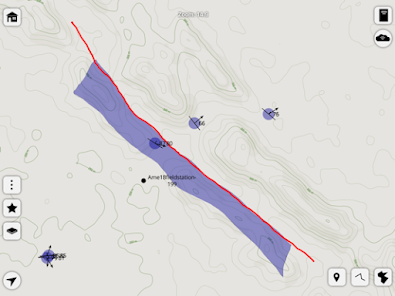
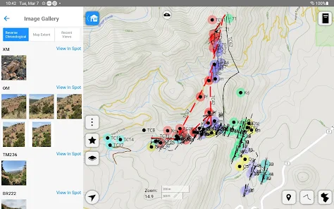
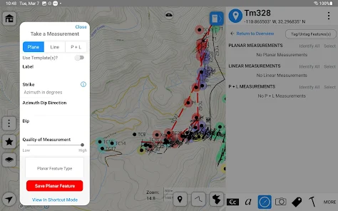
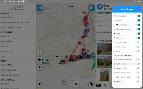
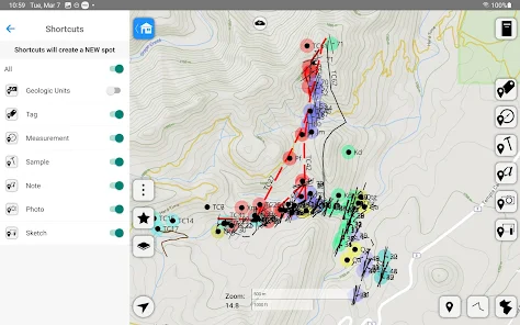
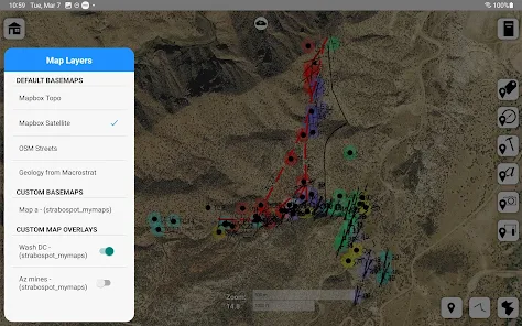
StraboField is a geological field data collection system supported by the National Science Foundation. Its map-centered interface facilitates the digital capture of georeferenced observations as points, lines, or polygons, termed 'Spots'. Sessions involve recording orientation data, imagery, sketches, and notes, with Spots nested to document multi-scale relationships. The system functions fully offline for use in remote environments; collected data can be synchronized to the StraboSpot.org database when connectivity is available, ensuring data integrity from field to archive.

Evidence & Research Context

  • The system's design, detailed in associated research articles, is based on established geological field workflows and was initially developed for the structural geology community.
  • The StraboSpot data architecture leverages a flexible graph database to organize information through spatial 'Spots' and conceptual 'Tags' to document complex geological relationships.
  • Research describes the system's expansion to incorporate sedimentology and stratigraphy, including a dedicated 'Strat Mode' and standardized vocabulary developed through expert workshops.
  • The platform is part of a larger initiative to create a shared, open-source digital infrastructure that promotes standardized data collection and sharing in the geological sciences.

Intended Use & Scope

This system is intended for geoscientists, researchers, and students for the structured digital collection of primary field data. Its primary utility is to standardize and archive georeferenced observations. The application is a data capture and organization tool; it does not perform geological analysis, modeling, or interpretation, which must be conducted with discipline-specific software and professional expertise.

Studies & Publications

2 publications

Peer-reviewed research associated with this app.

Development/Design Paper

Bringing sedimentology and stratigraphy into the StraboSpot data management system

Duncan et al. (2021) · Geosphere

Describes the research-driven development of this app
The StraboSpot data system provides field-based geologists the ability to digitally collect, archive, query, and share data. Recent efforts have expanded this data system with the vocabulary, standards, and workflow utilized by the sedimentary geology community. A standardized vocabulary that honors typical workflows for collecting sedimentologic and stratigraphic field and laboratory data was developed through a series of focused workshops and vetted/refined through subsequent workshops and field trips. This new vocabulary was designed to fit within the underlying structure of StraboSpot and resulted in the expansion of the existing data structure. Although the map-based approach of StraboSpot did not fully conform to the workflow for sedimentary geologists, new functions were developed for the sedimentary community to facilitate descriptions, interpretations, and the plotting of measured sections to document stratigraphic position and relationships between data types. Consequently, a new modality was added to StraboSpot—Strat Mode—which now accommodates sedimentary workflows that enable users to document stratigraphic positions and relationships and automates construction of measured stratigraphic sections. Strat Mode facilitates data collection and co-location of multiple data types (e.g., descriptive observations, images, samples, and measurements) in geographic and stratigraphic coordinates across multiple scales, thus preserving spatial and stratigraphic relationships in the data structure. Incorporating these digital technologies will lead to better research communication in sedimentology through a common vocabulary, shared standards, and open data archiving and sharing.
... Read More
Development/Design Paper

StraboSpot data system for structural geology

Walker et al. (2019) · Geosphere

Describes the research-driven development of this app
StraboSpot is a geologic data system that allows researchers to digitally collect, store, and share both field and laboratory data. StraboSpot is based on how geologists actually work to collect field data; although initially developed for the structural geology research community, the approach is easily extensible to other disciplines. The data system uses two main concepts to organize data: spots and tags. A spot is any observation that characterizes a specific area, a concept applicable at any spatial scale from regional to microscopic. Spots are related in a purely spatial manner, and consequently, one spot can enclose multiple other spots that themselves contain other spots. In contrast, tags provide conceptual grouping of spots, allowing linkages between spots that are independent of their spatial position.The StraboSpot data system uses a graph database, rather than a relational database approach, to increase flexibility and to track geologically complex relationships. StraboSpot operates on two different platform types: (1) a field-based application that runs on iOS and Android mobile devices, which can function in either Internet-connected or disconnected environments; and (2) a web application that runs only in Internet-connected settings. We are presently engaged in incorporating microstructural data into StraboSpot, as well as expanding to include additional field-based (sedimentology, petrology) and lab-based (experimental rock deformation) data. The StraboSpot database will be linked to other existing and future databases in order to provide integration with other digital efforts in the geological sciences and allow researchers to do types of science that were not possible without easy access to digital data.
... Read More

StraboField

Free