Flyover Country
Published in academic literature
App Summary
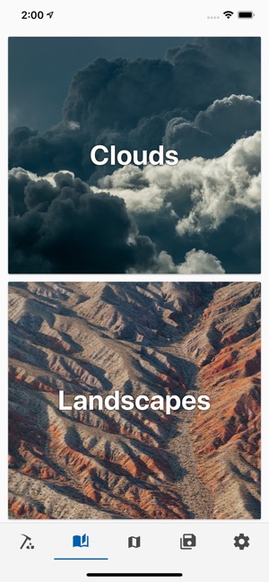
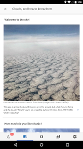
App Screenshots
Detailed Description
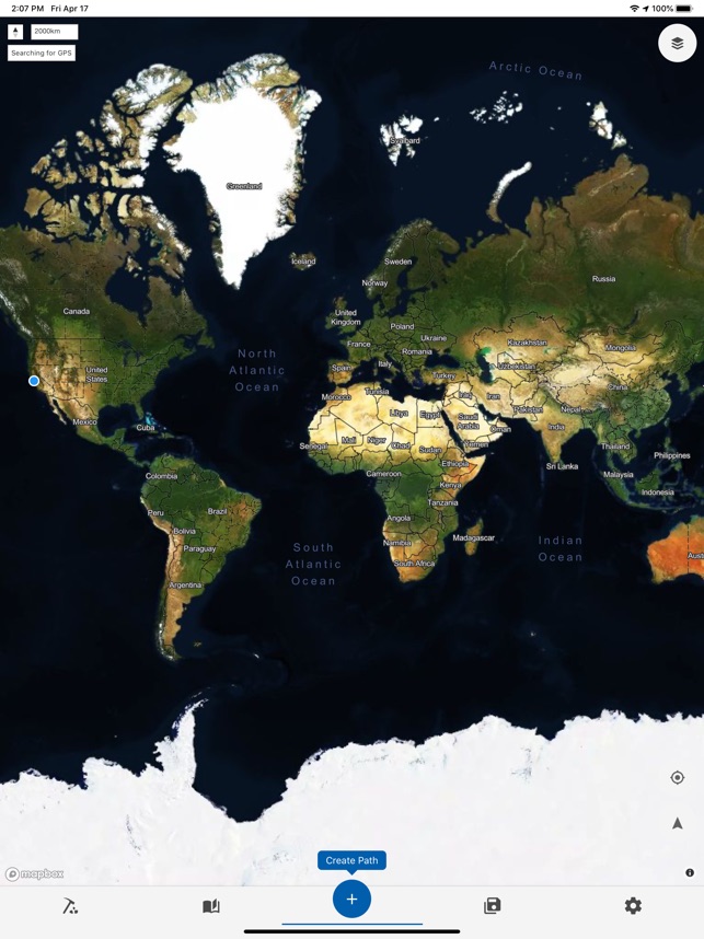
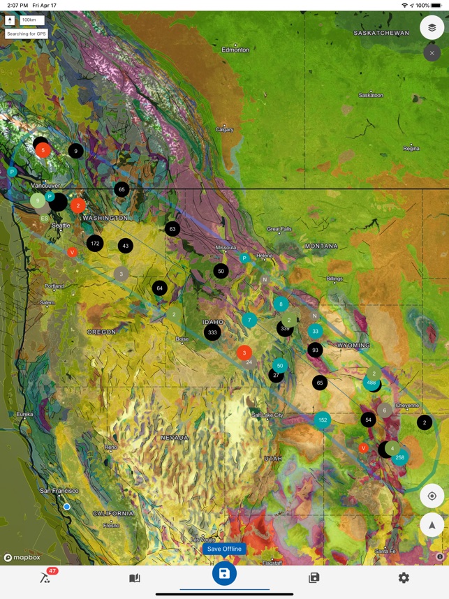
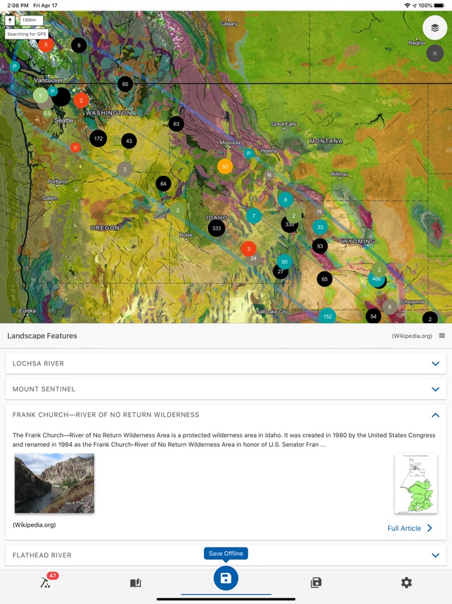
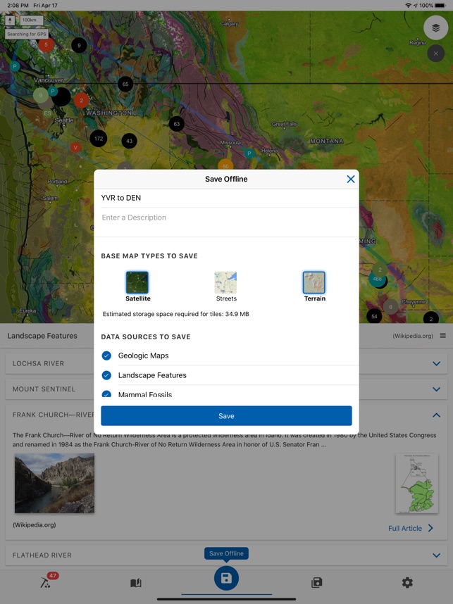
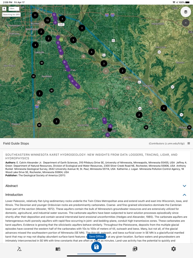
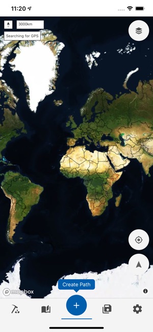
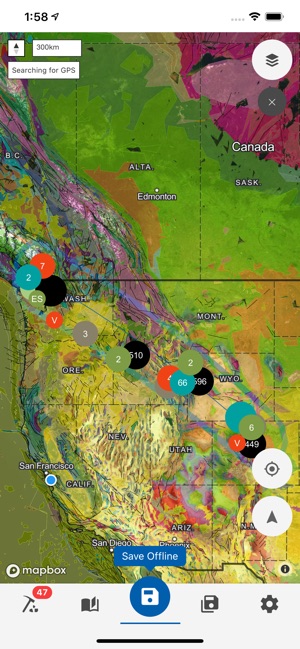
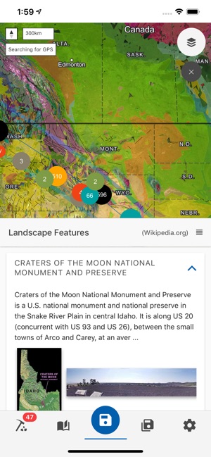
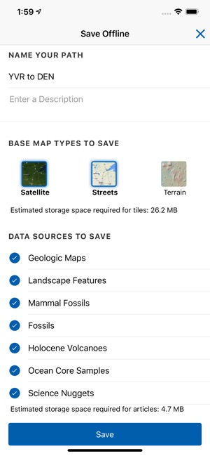
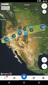
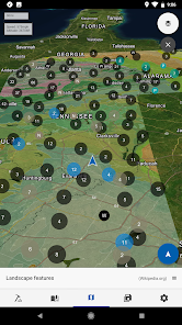
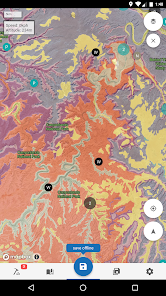
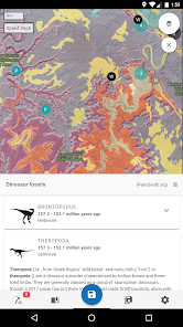
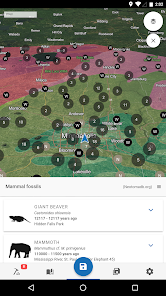
Functionality & Mechanism Developed at the University of Minnesota with National Science Foundation funding, Flyover Country delivers geospatial geoscience data for offline use. The system requires a user-defined travel path, along which it caches relevant datasets from sources including Macrostrat, the Paleobiology Database, and Neotoma. During travel, the interface leverages the device's GPS to display interactive geologic maps, fossil localities, and georeferenced articles in real-time. This mechanism facilitates data exploration without requiring an active internet connection.
Evidence & Research Context
- The system's architecture is designed to improve geoscience data access by integrating disparate databases for mobile, offline visualization, as detailed in several design papers.
- Associated research describes the app's application in undergraduate education to facilitate self-guided field trips, potentially increasing accessibility for students with scheduling constraints.
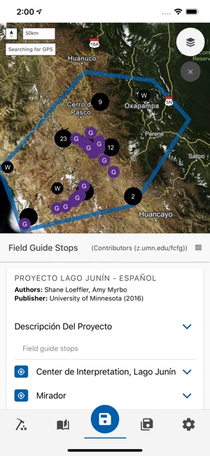
- The platform enables educators to upload and disseminate novel field guides, a functionality demonstrated and documented in geoscience education settings.
- The app's user experience (UX) and user interface (UI) design process has been formally documented, focusing on scenario-based design for public science outreach and educational use.
Intended Use & Scope This application is intended for geoscience educators, students, researchers, and the general public as an educational and data discovery tool. Its primary utility is facilitating self-guided exploration of curated geological and paleontological data. The platform is a data visualization tool and does not substitute for formal, instructor-led fieldwork or primary data analysis. Functionality is dependent on GPS signal quality.
Studies & Publications
Peer-reviewed research associated with this app.
Mobile UX design: learning from the Flyover Country mobile app
Loeffler et al. (2019) · Journal of Maps
Describes the research-driven development of this appImproving geoscience data access and interoperability through the Flyover Country mobile app
Loeffler et al. (2018)
Describes the research-driven development of this appIn the Media
App that Allows Airplane Passengers to Access Geological Data about Terrain Below
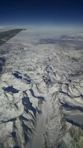
University of Minnesota researchers developed Flyover Country to help airplane passengers learn about geological features while traveling, using accessible geological data about the terrain below. The app was featured on Big Picture Science and published by NSF Science 360 for its innovative approach to making earth science education available during flight.
This University of Minnesota Student Wants You to Get to Know "Flyover Country"
The University of Minnesota developed Flyover Country to help travelers learn about geographical points of interest as they pass over landscapes, using interactive mobile technology. Graduate student Shane Loeffler from the Earth Sciences program created the app after spending plane flights "staring at the earth below, wondering what you're passing." The app enables users to identify and explore the landscape around them during travel.
Flyover Country app released
Funded by the National Science Foundation, researchers in the University of Minnesota's Department of Earth Sciences developed Flyover Country to help users discover geological features below their flights, using GPS tracking and offline data caching. Officials note that "by downloading only the data relevant to a particular flight path, file sizes remain reasonable, allowing for a robust experience without a live Internet connection." The free app is available for both Android and iOS devices.
Popular geosciences mobile app adds 53 new field trip guides with 400 stops
The University of Minnesota developed Flyover Country to make geoscience data accessible during travel, using integrated maps and GPS technology to reveal geological points of interest. The app recently added 53 new field trip guides with almost 400 stops for Colorado and surrounding states, with data donated by the Geological Society of America. "In the past, instructors had to carry five or more heavy, textbook-sized field trip guides. Now they can have all the information on their phone and everyone can have their own copy for free," said developer Amy Myrbo.
Go aerial sight-seeing with Flyover Country : iPad Pilot News
The University of Minnesota developed Flyover Country to help pilots and passengers identify landmarks and geographic features during flights, using extensive Wikipedia databases and geologic maps from Macrostrat.org. The app allows users to create flight paths between two points in the US and saves all relevant data in offline format for use without internet connection during flight. When paired with GPS, the app tracks location and displays nearby points of interest within 100 miles of either side of the flight plan.
Travel App of the Week: Flyover Country
The National Science Foundation funded Flyover Country to help travelers learn about geology and points of interest during flights, hikes, or road trips using offline GPS tracking technology. The app "exposes interactive geologic maps from Macrostrat.org, fossil localities from Neotomadb.org and Paleobiodb.org, Wikipedia articles, offline base maps" and analyzes flight paths to cache relevant data without requiring in-flight wifi. Flyover Country is available free for both iOS and Android devices.
What's the story in Flyover Country? There's an app for that!
Geology student Shane Loeffler developed Flyover Country to help air travelers identify geological formations and landscapes visible from airplane windows, inspired by his own flight experience observing glaciated rock formations of the Canadian Shield. With support from a National Science Foundation grant, Loeffler created this guide that shows fliers exactly what they're seeing thousands of feet below. The app is now available for free download.
Earth science researchers develop free mobile app for geoscience outreach
University of Minnesota Department of Earth Sciences researchers developed Flyover Country to help users discover geological points of interest during flights and outdoor activities, using GPS tracking and offline cached data relevant to specific flight paths. The National Science Foundation-funded app integrates interactive geologic maps from Macrostrat.org, fossil localities from multiple databases, and georeferenced Wikipedia articles without requiring in-flight WiFi. In February 2016, the team received a new three-year NSF grant for continued app improvements.
App Information
Developer
University of MinnesotaCategory
Evidence Profile
Published in academic literature
Platforms
Updated
Dec 2024
© 2025 University of Minnesota